[ad_1]
Why It Matters: On a warmer planet, rainstorms are stronger.
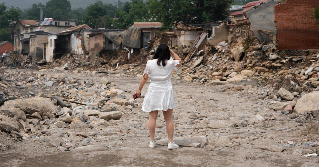
Human-driven climate change is amplifying flood threats globally. Rising sea levels are leading to more destructive coastal storm surges. A warmer atmosphere can hold more moisture, which means storms are primed to deliver more rain.
But in many countries, the more significant driver of flood exposure is increased building in unsafe places, said Jun Rentschler, a World Bank economist and lead author of the new study.
“Ideally, what we would like to see is that human settlements are avoiding these flood zones,” Dr. Rentschler said. “What we find is, on average globally, it’s the opposite that’s happening: Rather than gradually reducing exposure to flood hazards, many countries are rapidly increasing it.”
The reasons construction takes place despite the danger can be many, and Dr. Rentschler and his colleagues didn’t try to analyze which ones were most important in specific places. In some nations, the safest land might already be occupied, forcing new development to occur in hazardous areas that had once been avoided. Governments also want property-tax revenues. People want second homes. And waterfront living has long had a certain appeal.
Background: Satellite images reveal construction in flood zones.
In the study, which was published on Wednesday, the researchers analyzed decades of satellite data to see how the physical footprints of cities and towns changed worldwide between 1985 and 2015. They then compared this expansion with high-resolution maps of present-day flood exposure.
They found that, around the world, humans occupied about 56,000 square miles of flood-prone land in 2015, up from 26,000 three decades earlier. This growth was much faster than overall settlement expansion during that time.
The researchers defined flood-prone areas as ones that would be inundated by more than half a meter, or about a foot and a half, during flood events that have a 1 percent chance of occurring in any given year.
The study didn’t account for flood defenses such as dikes, levees, dams and drainage systems. One reason, Dr. Rentschler said, is that there isn’t a good global inventory of such structures. Another is that, even in places with artificial flood protections, understanding the vulnerability can help policymakers develop early-warning systems, evacuation plans and emergency responses, and figure out what to do if their infrastructure gives out.
“When we have big disasters, it’s often because those defenses fail,” said Stéphane Hallegatte, a senior climate change adviser at the World Bank and another author of the study. He pointed to the catastrophic recent floods in Libya, where torrential rains caused two aging dams to burst, killing at least 4,000 people and displacing 43,000.
“We have been working quite a lot with countries, making sure when they build infrastructure, they don’t assume the job is done because the risk is gone,” Dr. Hallegatte said.
What’s Next: Monitoring flood-prone development in real time.
Dr. Rentschler said he hoped that this kind of data could someday help inform government policies by tracking economic development that exposes people and structures to greater flood risk.
“Often it can be convenient to think of climate change as an exogenous force that’s beyond the influence and power of local authorities,” Dr. Rentschler said. And yet, it’s state, county and city officials who approve new developments and enforce zoning regulations, he said. “What this study really shows is that, in terms of exposure and people’s vulnerability, the action really is local.”
[ad_2]
Source link