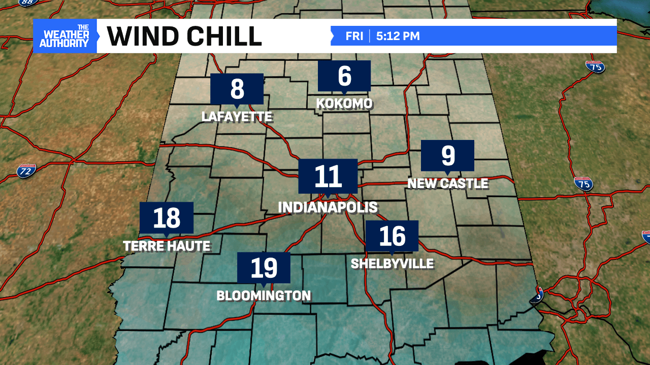
January 3rd was chilly on all accounts with wind chills in the single digits to end the day. While the weekend looks to start dry, the big story will be Sunday into Monday with the snowstorm in the forecast. This could bring some of the biggest snows to Central Indiana in nearly three years.

Weekend starts chilly and dry
After the coldest night in nearly three weeks commences, the weekend will start dry and chilly. Highs on Saturday will be in the mid-to-upper 20s with clouds increasing late. Those clouds will be the precursor to Sunday’s wind-driven heavy snow event. Snowfall potential could approach territory Central Indiana hasn’t seen since February 2022.


Let’s talk about Sunday
Snow will still happen Sunday. Heavy snow will occur in several hometowns. The question still remains of which spots will receive the heaviest snow totals. Given the latest trends, we think the heavier snow band will be south of the I-70 corridor. This is where the 6.0″+ snowfall potential exists. The shift compared to our earlier forecast is the heavier band about 30-40 miles south. We also think once you go along/north of I-70, there will be a sharp cut-off in snow totals.

The track of the storm is something that will continue being fine-tuned overnight and into Saturday. We’ll also be keeping an eye on temperatures as the snow approaches. There will be plenty of moisture for the snow to work with, hence why heavy snow is still in the forecast.

A Winter Storm Watch goes into effect Sunday morning and continues through the day Monday. This system will cross several states before reaching Central Indiana. Spots in far south Indiana could see a mixture of rain/ice rather than all snow. We’ll be watching for that position of the freezing line too.
Further fine-tuning of the snow forecast will occur before its arrival on Sunday. Expect snow in spots through midday Monday before the cold air rushes in.


After the snow, Arctic air returns to our neck of the woods. It will be very stubborn to get out of here with well-below-normal temperatures favored. This will be the story starting midweek and into the following week. Depending on the snowpack, it will aid in providing sub-zero low temperatures in the spots with the most dense snowpack on the ground. Highs will be in the teens to near 20° during this timeframe.


