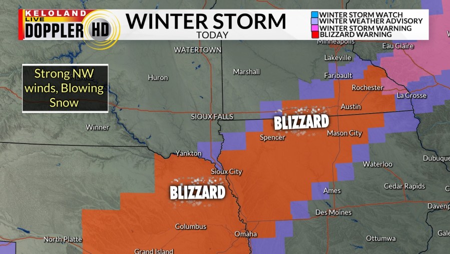
SIOUX FALLS, S.D. (KELO) — A significant mid March storm is tracking just south of KELOLAND this morning, bringing with blizzard conditions to much of eastern Nebraska and portions of northwestern Iowa. You can see the intense band of snow on the radar loop below. Wind gusts near 70mph have been reported in central Nebraska this morning.
Blizzard headlines still include Spencer, Primghar, and Sioux City this morning. Whiteout conditions and dangerous driving is forecast in these areas today. Sioux Falls is not included in any headlines for snow today.

Snow totals will jump quickly across the warning area. Local amounts over 6″ are possible toward Spencer and Cherokee.

Our short-term forecast shows highs near 40 later in Sioux Falls.

You can see the edge of the snow as it bypasses south of Sioux Falls this morning. Skies should remain dry to the west and stay that way into tomorrow. With less wind on Thursday, with should return to the 50s and lower 60s across KELOLAND.
Very windy weather is forecast for much of southern and eastern KELOLAND. You can see the latest wind gusts on the video below.
Here are the details of the forecast.


