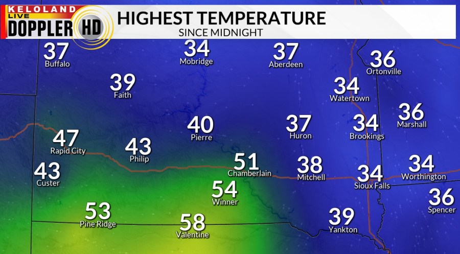
It was a dreary Sunday that started with freezing fog, but warmer temperatures decreased the slipperiness hazard through the day. Afternoon temperatures were actually above normal for mid-December.

Low clouds will hang on through the evening in eastern South Dakota, and then break up toward morning. A westerly breeze and the cloud cover will prevent temps from dropping off too much, with low mainly in the 20s by morning. There could be a sprinkle or brief snow flurry in Sioux Falls and SE South Dakota early Monday morning.

Monday afternoon will be windy, with a brisk west wind that will eventually wind around to the northwest. It will be a warming wind, with highs in the 30s in the north and low 40s in southern parts of KELOLAND. Skies will be partly to mostly sunny.

We have a fast-moving, moisture-starved clipper system moving through from the northwest on Tuesday. We’re looking at snowfall with limited accumulation, under an inch in most places. Fortunately, the winds won’t be as strong so that will limit the blowing snow factor. Highs will reach the mid 20s to low 30s.

We’ll have another low-end shot at snow showers on Thursday. That will be followed by a shot of cold air. Saturday looks to be coldest, with highs only in the teens despite mostly sunny skies Saturday. That seems appropriate, since Saturday is the first day of Winter.

As far as the White Christmas outlook, we still see no signs of any big snows, with only shots of light snow over the next ten days. In fact, Christmas Eve and Christmas Day are looking warm, near 40 in Sioux Falls!

