SIOUX FALLS, S.D. (KELO) — From severe weather to blizzards, the month of March has certainly turned more active across the plains. But is all this weather whiplash improving our spring moisture outlook? Meteorologist Brian Karstens takes a closer look.
The parade of storms continues this week as another sizable storm with wind pushed through the plains. But are these storms making a difference on the spring moisture outlook? The answer to that question may be surprising.
Mid march is a classic time of year to see wild swings in temperatures in KELOLAND. As we experience each storm, it’s important to recognize the current impact of these early spring storms and how that might change into April and May.

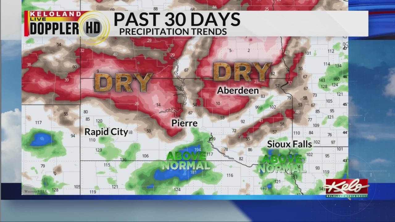
First, the 30-day precipitation trends are better in far southern KELOLAND, with several areas south of I-90 running above normal. Sioux Falls has 1.14″ in the books for the month. This latest storm will bring a band of heavy wet snow to Nebraska and Iowa, leading to even higher trends in those 2 states. But notice who’s missing the moisture.


Not only is northern South Dakota into North Dakota low on rain and snow, a large area of Texas is turning very dry.

Now look at the 15-day forecast. Notice again, west Texas is dry. A common concern in the spring is when west Texas turns hot and dry early in the growing season, the heat feeds back into the upper-level ridge in the jet stream as the days grow longer.
It’s too early to say how much that trend could impact the ongoing drought in KELOLAND, but it’s another factor we are watching. For KELOLAND Weather, I’m meteorologist Brian Karstens.