Good morning KELOLAND! Snow has developed overnight in parts of western SD, a trend that will expand this weekend. You can see the light snow on the video below taken from our LIVE Cam at Terry Peak.
On radar, the snow has been increasing in the west, but we still think the snow amounts will stay light today.
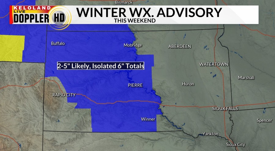
A Winter Weather Advisory has been posted for the areas shaded in blue this weekend. Snow totals of 2-5 inches are expected. This advisory does not include the Sioux Falls area.

Temperatures will be trending colder. You can see the latest hourly forecast for the Sioux Falls area today.

Futurecast shows the snow in blue across western KELOLAND. That snow band should expand tomorrow and may get close to Sioux Falls. With temperatures in the single digits and teens, the snow will be very powdery. Thankfully, strong winds are not forecast with this system.
The map below shows the latest chances of accumulating snow, with a slight shift to west once again.

The chances of 3 inches of snow or more lines up well with the Winter Weather Advisory area.

While we don’t expect strong north winds, wind chills will be consistently below zero the next several mornings, with the coldest air likely arriving Tuesday or Wednesday morning. Stay warm the best you can!
Take a look at the storm track into early next week. Folks in Kansas and Missouri are going to have a quite a storm on their hands. Widespread snow and ice are forecast in these regions to our south.
Here are the details of the forecast.


