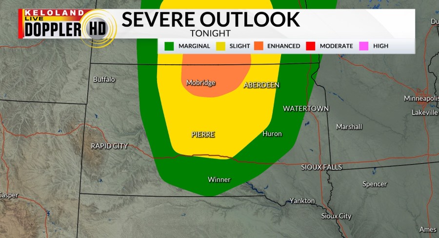
We will be watching the skies across central South Dakota this evening as thunderstorm development will be possible. If these storms do develop, severe weather is a distinct possibility. The Storm Prediction Center has maintained an enhanced risk of severe weather in the areas shaded in orange on the map below.

The cold front responsible for these thunderstorm chances will advance eastward tomorrow. As a result, we do anticipate scattered thunderstorm chances to increase East River in the afternoon and evening hours. Some severe weather cannot be ruled out. We do expect this cold front to clear the region late Thursday with sunny skies likely on Friday.

A very nice Labor Day weekend is ahead for KELOLAND. High temperatures will stay in the 80s on Saturday, with cooler weather likely for both Sunday and Labor Day. Dry skies are likely throughout much of the 7-Day forecast.


