As remnants of the once Category 5 Hurricane Beryl approach the threat of a few thunderstorms capable of producing a tornado rise
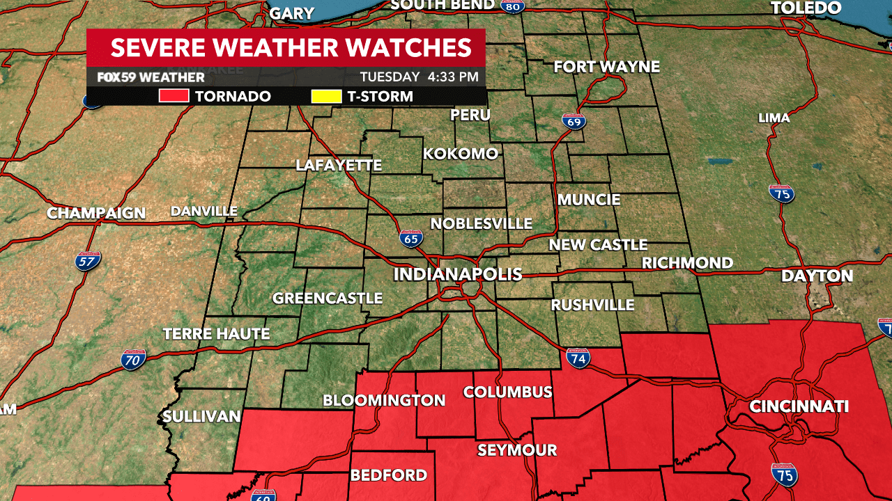
TORNADO WATCH ISSUED
The National Weather Service has Issued a tornado watch for a portion southern Indiana through 12am Wednesday morning. Showers and thunderstorms will increase in coverage late this evening and few storms are capable of producing brief/small tornadoes.
The upper-level spinning in the atmosphere, the core of once Category 5 hurricane Beryl will pass overhead during the early morning hours of Wednesday. The threat for a storm or two to produce a tornado will be at its height from 7pm to 11pm especially in southeast and east-central Indiana.


LOCALLY HEAVY RAINFALL
Tropical downpours are also expected late this evening and the treat for a flash flood warning is also on the rise. Amounts could top 3″ but in localized fashion. Flooding will be a concern even after the rains ease through early Wednesday morning.
