SIOUX FALLS, S.D. (KELO) — Despite rain we had early on in the spring and summer — a drought is now expanding in KELOLAND.
Expect dry skies through the rest of the month, as a result some will go down as their top five driest Septembers on record, and the drought monitor reflect that.
Summertime heat will continue through the weekend as highs will remain in the 80s and 90s. Throw in a strong wind, a fire danger will remain high. The drought monitor continues to worsen across KELOLAND.
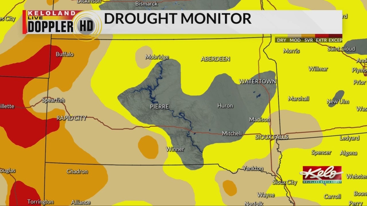
Here’s the latest look at the drought monitor.

The extreme category continues in western South Dakota, especially into the Black Hills.
At the same time, the moderate category continues to expand in southeast KELOLAND as it now expands form northeast Nebraska to southwest Minnesota.
And, north central to northeast KELOLAND is now seeing drought conditions with the moderate category just west of Mobridge.
We’ve been saying, what you see is what you get. Warm and dry skies will continue through the weekend. Even when cooler temperatures return for a limited time next week, it will remain dry. And a sneak peek at October is showing warm and dry skies will last through at least the first half of the month.