SIOUX FALLS, S.D. (KELO) — Summer heat is returning to KELOLAND next week and that means more drought stress across western KELOLAND.
Dry skies and lots of sunshine are nice for outdoor activities. But the lack of rain is becoming a bigger concern in western KELOLAND with no relief anytime soon.
The sights and sounds of summer are still all around us.
And while fall-like weather has given us a brief tease, another round of summer heat is just around the corner.

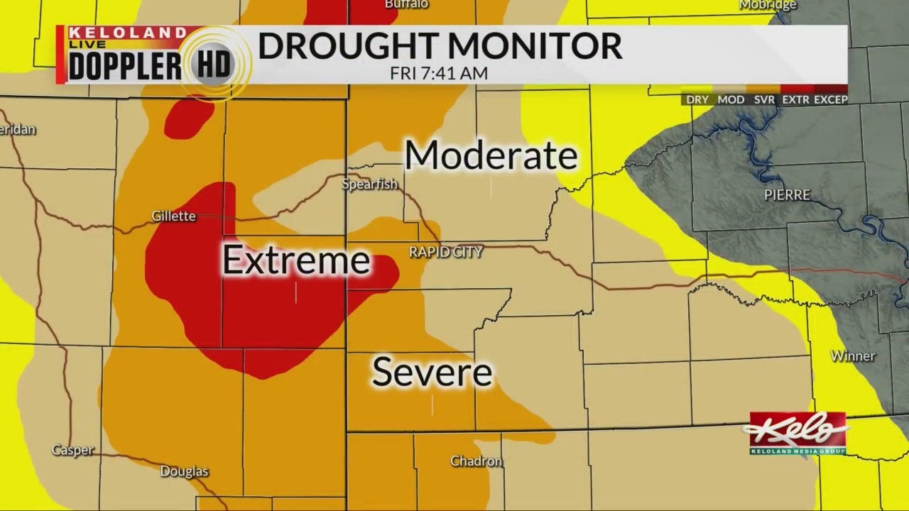
Hot and dry weather is leading to expanding drought in western KELOLAND. In fact, the latest drought monitor shows a 6 percent increase in drought in South Dakota, with 31 percent of the state in drought. The worst deficits are showing up in the Black Hills, where extreme levels are shown in red on this map.

Even Sioux Falls and the southeast areas are now “abnormally dry”. This is a dramatic change from the picture just a few short weeks ago when flooding was all the talk.

The humidity forecast will contribute to the lack of rain chances and the fire danger in the west. The maps for both Monday and Tuesday shows afternoon humidity levels at 10 to 20 percent in southwestern KELOLAND.
As a result, elevated fire danger will be our top weather story early next week. Look for more details in the days ahead. For KELOLAND Weather, I’m meteorologist Brian Karstens.