Just like Saturday, it’s been a hot and humid day for several portions of KELOLAND. Fortunately, it has been pretty quiet today as well…so the clean up from last night’s storms can go on without a major hitch.
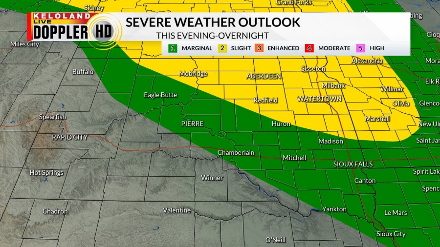
Unfortunately, some portions of KELOLAND may still see some overnight showers and thunderstorms that could become strong to severe. A “Slight Risk” for severe weather is in place for northeastern KELOLAND, with a “Marginal Risk” extending south and west of that area.


Damaging wind gusts and large hail are the main concerns, but there’s always an isolated tornado risk with any storm. Please stay weather aware through the night, as these storms are expected to arrive near and after midnight. Have your StormTracker App and a NOAA radio ready to receive the latest updates and warnings.
Additional scattered showers and thunderstorms are possible as we go into the day on Monday, with chances increasing the closer to and south of I-90 you go.

A “Marginal Risk” for severe weather is in place for a majority of South Dakota south of US Highway 212, with a “Slight Risk” in Minnesota. Wind and hail are the main concerns, but again…an isolated tornado is possible especially toward Minnesota and northern Iowa.

A few more showers and storms are possible on Tuesday, especially West River, but we do have some better weather to enjoy by the second half of the week.
Outside of a few terrain driven storms to the west toward the Hills, we have a good amount of sunshine and more comfortable temperatures in place.
By the weekend, a little instability returns with some spotty shower and storm chances, but we should end up being more dry than wet.
Here’s a look at your extended forecast:


