
 Getty Images
Tropical Storm Helene has intensified into a hurricane and is predicted to turn into a dangerous Category 3 storm before hitting the US Gulf Coast on Thursday.
Forecasters warn the major hurricane could bring “life-threatening” storm surge, damaging winds and flooding to a large portion of Florida and the south-eastern US.
The US-based National Hurricane Center (NHC) said that Helene was expected to pass the north-eastern Mexican coast of Yucatán in the coming hours and hit Florida late on Thursday local time.
Florida Governor Ron DeSantis has declared a state of emergency for almost all of the state’s counties.
Map of Tropical Storm Helene’s path
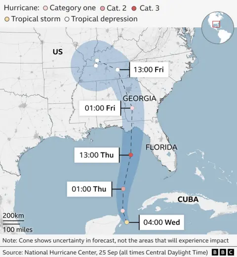
Data from the National Oceanic Atmospheric Administration indicates that maximum sustained winds from the storm have increased to near 80 mph (130 km/h).
At 12:00 GMT, Helene was moving north-west from its position east of the Mexican state of Quintana Roo.
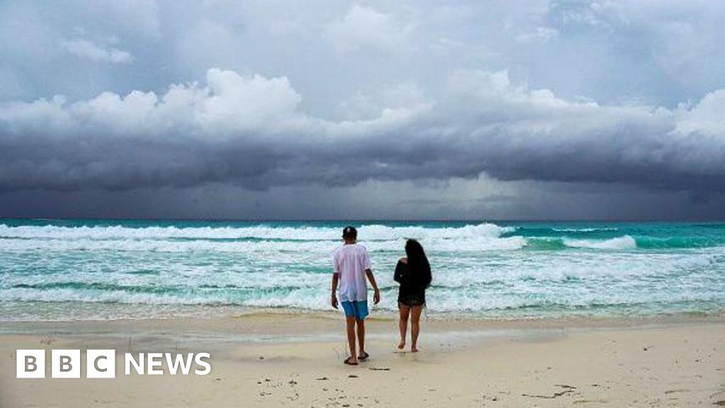
Mexico’s meteorological service said it could not rule out that the popular resorts of Cancún and Cozumel could be hit in the early hours of Wednesday local time.
Red flags warning swimmers not to venture into the sea were flying on the beaches of Cancún as early as Tuesday and fishermen rushed to get their small boats out of the water.
 Reuters
Local businesses were boarding up their windows as torrential rain began to fall and high winds blew.
Heavy rainfall from Helene is also expected to affect western Cuba and the Cayman Islands.
The NHC said that once Helene reaches the south-eastern United States, it is expected to “produce total rain accumulations of five to 10 inches” (12.7-25.4cm).
A flood watch has been issued from Florida to the southern Appalachians with the worst-affected area predicted to be the Big Bend region in Florida.
Big Bend is where Hurricane Idalia made landfall in 2023 and the area also was impacted by Hurricane Debby last month.
The Florida Division of Emergency Management has posted a list of the counties in which voluntary or mandatory evacuation orders have been issued ahead of Helene.