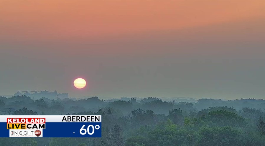
SOUTH DAKOTA (KELO) — Good morning KELOLAND! A warm summer day is ahead for the region and hotter weather is just around the corner. You’ll notice the smoke too on the Aberdeen LIVE Cam. That picture was captured just before 6am.


The smoke from Canada is being pushed into the northern plains by the current jet stream pattern. Expect an increase in smoke tomorrow.
Our latest smoke forecast shows that trend developing in North Dakota and expanding to the south the next 36 hours.
While most of the weather has been focused on the flooding and wet weather this summer, most of this forecast is drier and hot. We will continue to watch a fast things dry out in western SD as temperatures reach the 100s by the weekend.

You can see the warm numbers today on our hour-by-hour forecast. We also need to mention a few isolated or scattered hits of rain are possible in northeastern SD later today, with a 20 to 30% chance of rain tonight toward Sioux Falls. Click the video below for more details.
After that, there’s no escaping the hotter weather. Most of the region will be much above normal this weekend, with high humidity values in the east and drier heat West River. Don’t expect a lot of relief next week.
Our weather map for Friday shows lots of 90s, with a few 100s toward Rapid City.

Saturday should be even hotter. Expect some heat headlines too in the coming days.

Here are the details of the forecast.


