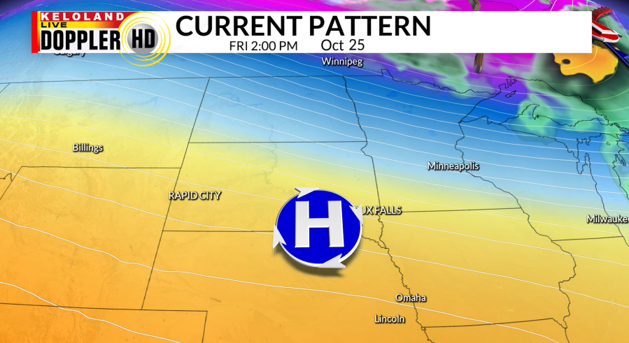
SIOUX FALLS, S.D. (KELO) — Radar and satellite have been quiet today as high pressure has slid in and kept our temperatures seasonable with light winds. Dry skies will continue for us after the trough moving off to the east brought showers yesterday.

It will be a calm night with clear skies and light winds that will drop our lows in the 30s. Scattered frost will be expected tonight with these conditions and as we head into tomorrow morning, winds will become southerly.

We will continue to slowly warm up going into the weekend with highs tomorrow mainly in the 60s, with a few upper 50s to the east and 70s to the west. Cloud cover will slightly increase East River, but otherwise we continue to stay dry and breezy. Breezy conditions throughout this weekend will lead to elevated fire danger.

Heading into Monday, temperatures will be well above-average across KELOLAND. You can see in the graphic below how our temperatures are affected as the ridge slides east. Looking to the western United States, a trough will form and we will continue to watch that as it moves closer, bringing us the potential for more rain.

Rain is much needed for us as drought continues to impact and worsen in portions of KELOLAND. As the active weather moves in going into the middle of the week, our temperatures will become much cooler.
