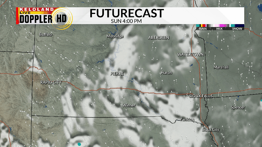
SIOUX FALLS, SD (KELO) — Most of the day has been rather quiet beyond a few isolated showers with the occasional rumble of thunder that has been able to make a quick appearance. With that said, though, we’re not in the clear yet from watching the skies…especially out west.
As we head into the evening and night, we’ll watch for the chance to see showers and thunderstorms pop up and move northeastward through western and central parts of KELOLAND.

A “Marginal Risk” for severe weather is in place for a good portion of western South Dakota as we head into the night, with wind and hail being the main concerns with any storm that gets its act together and moves through the area.

Another chance for a few showers and storms will come along for some early on Monday. Beyond that, the afternoon is mainly quiet beyond a small chance to see a pop-up storm or two later Monday night.

Chances for rain and thunderstorms increase as we head into the heart of next week. Keep an eye on the skies through Wednesday and Thursday for the chance to see scattered showers and thunderstorms. We may even have to include late Friday into Saturday into the mix as well.

Beyond the 7 day forecast, we may get a shift in our temperature pattern as more seasonable temperatures attempt to make an appearance just in time for the start of fall. With that said, however, we do remain well above average on the thermometer until at least Friday.

Here’s a look at your extended forecast:


