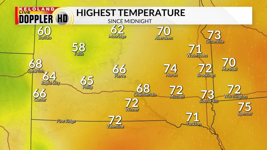
SIOUX FALLS, SD (KELO) — It has been a rather windy day across KELOLAND, but it has also been rather warm…especially East River.

A dry cold front will continue to push eastward through the evening and into the night. While we stay dry East River, rain begins to develop out west. This sets the stage for the midweek outlook, which has several moving parts to it.
First, the moisture. Rain starts out west on Tuesday and slowly creeps eastward through the day and into the night. Overnight into Wednesday, rain and even a rumble of thunder will be possible…the latter of which is possible to the east and southeast.

A “Marginal Risk” for severe weather is in place for portions of eastern and southeastern KELOLAND late Tuesday into the night. It’s a conditional risk, with wind and hail being the main concerns. Keep an eye out for changes.

Not everyone will be dealing with rain. In the Black Hills, a switch to snow is expected with cold air crashing in on the back side of this system. A winter storm watch is in effect for the Black Hills from Tuesday morning into Wednesday morning.

Several inches of snow will be likely, with higher amounts possible in the northern hills toward Lead and Deadwood. Travel will likely become hazardous, so please keep an eye out for updates on this first taste of winter that’s on the way.

After all of this, we dry out just in time for trick or treaters on Halloween. With that said, though, it’ll be chilly and a bit breezy at times.
We’ll stay dry and breezy on Friday before rain chances return on Sunday. A few showers may linger into early Monday to the southeast, but chances are low at the moment.

Beyond the 7 day forecast, while it will be closer to average, odds for above average temperatures will remain favored.
Here’s a look at your extended forecast:


