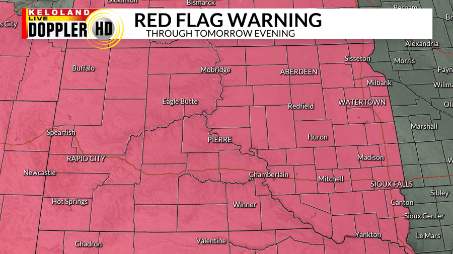
SIOUX FALLS, S.D. (KELO) — It has been a quiet day across KELOLAND with plenty of sunshine and temperatures climbing to above-average. As a low pressure system develops in Montana, winds will pick up today, especially West River. With our dry pattern ongoing and gusty winds, these conditions have prompted Red Flag Warnings for all of South Dakota through Saturday evening.

Although northeastern South Dakota had a frost advisory last night, that will not be the case for tonight as lows will stay above-average and mainly be in the 50s. Windy conditions will continue, along with mostly clear skies.

A cold front is expected to move through our region tomorrow and winds will shift to the northwest. Strong winds will be the main factor with this front with potential for gusts up to 60 mph for areas in the High Wind Watch (orange) and Wind Advisory (tan).


Temperatures will drop behind this cold front and temperatures will return to near normal going into Sunday with breezy conditions. Winds will become lighter heading into the beginning of the week and another ridge builds in, allowing us to warm back up. There will still be a lack of moisture in the atmosphere, leading to another week of dry skies.
