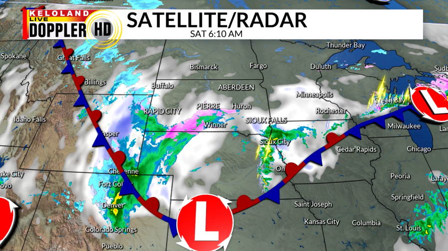
SIOUX FALLS, S.D. (KELO) — After a very warm day yesterday with highs reaching the mid 80s in Sioux Falls, we are already cooling down as a cold front moves off to the east. Another low pressure system has moved in to our south and will bring active weather to KELOLAND this weekend. A variety of precipitation is beginning to fall in southern KELOLAND and will become more widespread throughout the day.

Temperatures will continue to fall today into the 30s and 40s with a breezy northeast wind.

As the precipitation moves northward during the day, rain will transition to snow across central South Dakota. Rain will continue East River with embedded thunderstorms possible.

A Winter Weather Advisory will be effect across eastern and central KELOLAND today and into the early overnight hours. The heavier band of snow will set up during the mid-afternoon in south-central South Dakota with 3-5″ possible. Totals will stay lighter to the east as the band of snow moves into northeastern KELOLAND by this evening.

Lows will stay seasonable for tonight in the 20s and 30s. Winds will stay breezier East River, while winds start to calm down near the Rapid City area.

Rain and snow will continue to hang around during the morning and start to move out with the low pressure system going into the afternoon. Light snow showers will continue to linger out in western South Dakota for most of the day. By the end of the weekend, we will have received much needed rain in portions of KELOLAND.

We will dry out going into Monday, but it won’t be for long. Another system moves in by the middle of the week, bringing rain and snow chances across KELOLAND, along with breezier conditions. We will start to return to spring-like temperatures going into the start of next weekend.
