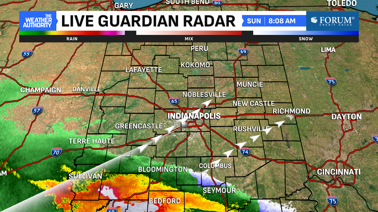
Rain is moving in from the south on Sunday morning. Even a few snowflakes are trying to mix in down near Bedford and Seymour. Those hometowns are the southern tips of our viewing area and are likely going to see the highest totals today. Umbrellas and raingear will be needed since it will be both windy and rainy.

Peak coverage of today’s rain will be close to midday and all afternoon long with nearly 100% coverage just after lunch. The rain will be around through the afternoon and early evening as coverage goes down around sunset. Severe weather is NOT expected but thunder and lightning are possible in the heavier storms.

The heavier rainfall potential exists south of I-70 in South Central Indiana. Some spots could see rainfall near or surpassing an inch in those spots. It’ll be a different story north of Indianapolis where amounts will be on the lighter side. Any rainfall is definitely welcome since many of our central Indiana counties are in a moderate drought.


Rain exits shortly after dinnertime and skies will clear tonight. The week will start on a seasonable note with highs in the mid-to-low 50s Monday-Wednesday. Those days will be dry except for Tuesday. We anticipate a weak cold front will slide through and give us more scattered showers later in the day.
Then, March will go out like a lion thanks to the return of southwest flow and an active pattern. Highs look to approach 60° by Thursday and surpass the 70° mark on Friday and Saturday. Those days look to give us more rain chances heading into March’s last weekend. Overall, the pattern looks to have warmer-than-average temperatures to close March and open April.


