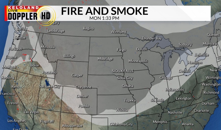
SIOUX FALLS, S.D. (KELO) — We are dealing with wildfire smoke coming down from Canada. Most of this smoke is higher up in the atmosphere so it’s creating hazy sunshine. The darker the gray on this map, the thicker the smoke is.

Today has had hazy sunshine. The wind has been very light. There have been a couple light sprinkles in the Sioux Falls area. High temperatures today have been just a few degrees below normal in central and eastern KELOLAND, but western South Dakota has been slightly warmer.

Tonight we will keep the winds light. There could be patchy fog in eastern KELOLAND, and smoky skies in western South Dakota. Low temperatures will be near normal in the low to mid 60s.

More hazy sunshine is on the way as we head into tomorrow. The Sioux Falls area could see a few more thundershowers. The winds will be light. High temperatures will start increasing compared to today.

Wednesday will be about the same. High temperatures in the 80s in eastern KELOLAND, 90s in central and western South Dakota. The winds will be light. There will be partly to mostly sunny skies.

Temperatures keep increasing as we head through the 7 day forecast. Low 90s return in Sioux Falls as we head into the weekend with stronger winds possible on Saturday. There are a couple chances for rain and thunderstorms as we head into Sunday and Monday.

Western South Dakota will be a little warmer. Highs reaching 100° by Thursday and Friday. Then daily chances of rain and thunderstorms will be around Friday through Monday. This will help drop temperatures just slightly.
