What to Know
- Statewide, the snowpack is 108 percent of average for Jan. 2.
- The manual survey at Phillips Station in the Sierra Nevada Mountains showed snow water equivalent at 91 percent of average for that location.
- Snow water equivalent is the amount of water in the snowpack once it melts and flows into the state’s water system.
- Although there are signs of optimism to start January, California has a history of extremes when it comes to snowpack.
- Thursday’s Drought Monitor update showed 31 percent of California, including Southern California, in moderate drought.
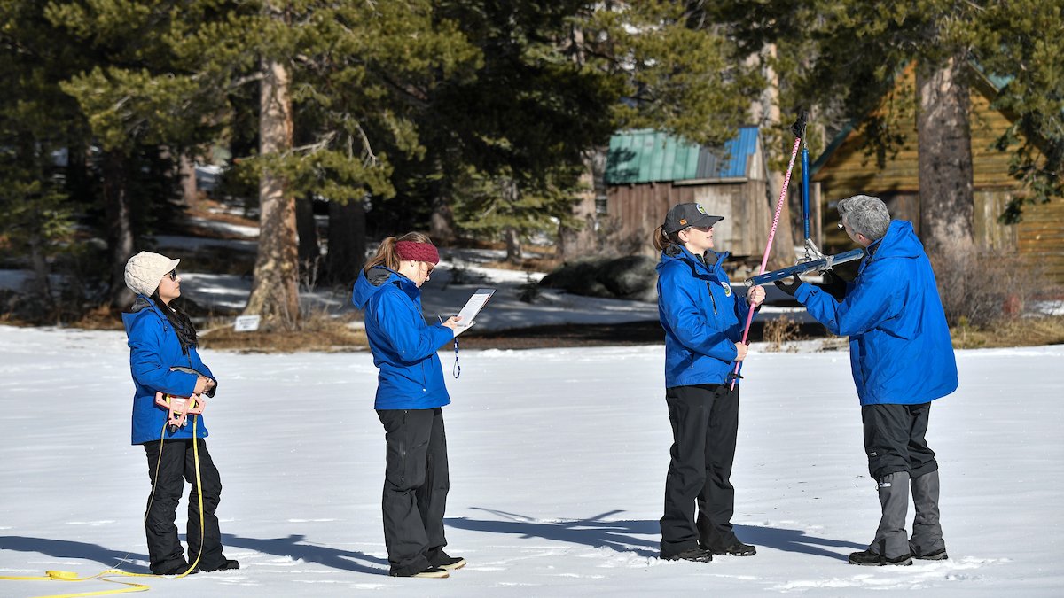
California’s first snowpack survey of the season, an early winter measurement of a critical part of the water supply in the nation’s most populous state, shows conditions are just about average for the start of January.
The manual survey at Phillips Station in the Sierra Nevada Mountains showed 24 inches of snow depth with a snow water equivalent of 9 inches. That’s 91 percent of average for that location.
Snow water equivalent is the amount of water in the snowpack once it melts. That water then flows into the state’s water system reservoirs and channels. Known as California’s frozen reservoir, the mountain snowpack supplies about 30 percent of California’s water needs.
Statewide, the snowpack is 108 percent of average for Jan. 2. The monthly Phillips Ranch survey and others are conducted manually, but the state water agency uses electronic readings from 130 stations throughout the Sierra Nevada Mountains to get an idea of supply ahead of the hot and dry summer months.
The statewide snowpack’s snow water equivalent is 10.7 inches, or 108 percent of average for this date. It was 28 percent on Jan. 2, 2024, a significant difference due in large part to snow produced late last year by several atmospheric river-fueled storms this season in Northern California.
There are notable differences between the southern and northern snowpack. In extreme Northern California, which received the bulk of the state’s snowfall from early season storms, snowpack was at 161 percent of normal for the start of January. In the southern region, snowpack was at 75 percent.
— CA – DWR (@CA_DWR) January 2, 2025
“While our snowpack looks good now, we have a long way until April when our water supply picture will be more complete,” said California Department of Water Resources Director Karla Nemeth. “Extreme shifts between dry and wet conditions are continuing this winter and if the past several years are any indication, anything could happen between now and April and we need to be prepared.”
Although there are signs of optimism to start January, California has a history of extremes when it comes to snowpack. In 2013 and 2022, the January snowpack was well above average after a series of snowstorms, but dry conditions persisted through the remainder of winter.
California has seen two consecutive years of above-average snowpack, leaving major water reservoirs at 121 percent of average to start January. The back-to-back years of heavy snowfall came after the driest three-year period on record in California.
DWR today conducted the first Phillips Station snow survey of the season. The manual survey recorded 24 inches of snow depth and a snow water equivalent of 9 inches, which is 91 percent of average for this location. Statewide, the snowpack is 108 percent of average for this date.… pic.twitter.com/9gx8O5MvUQ
— CA – DWR (@CA_DWR) January 2, 2025
“We are fortunate to have had several solid snow-producing atmospheric river systems so far this season,” said DWR Snow Surveys and Water Supply Forecasting Unit Manager Andy Reising. “The fall was extremely dry, so our healthy snow totals are thanks to a handful of big storm systems in November and late December. But to finish the year where we need to be, we will still need additional snow building at a regular pace throughout the winter.”
The next survey is tentatively set for Feb. 3.
Thursday’s Drought Monitor update showed 31 percent of California, including Southern California, in moderate drought, the least severe of the weekly report’s four drought categories. Nearly 6 percent of the state is in severe drought with a sliver along the Arizona border in extreme drought.
At this time last year, no part of the state was under a drought designation.


