Showers and a few storms will remain possible as we head into the afternoon and evening, but at least it hasn’t been as chilly East River as it was on Monday. We at least got into the 70s this time, though that’s still below average for this time of year.
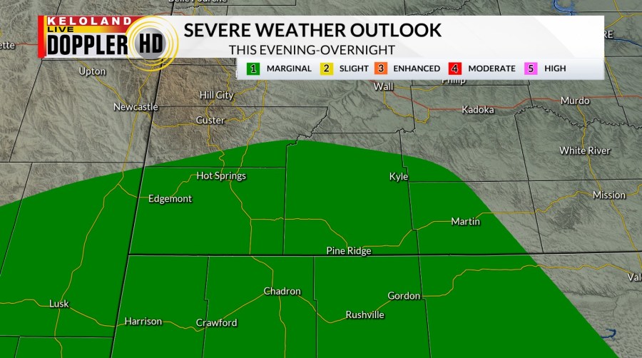
A “Marginal Risk” for severe weather will remain in southwestern South Dakota as a few storms may pack an extra punch. Wind and hail will be the main concerns.

Beyond that, we’ll quiet down as we head into the night with partly to mostly clear skies in place. This will allow temperatures to fall into the 50s for overnight lows…a comfortable night for much of the region.
Wednesday starts off well enough with clearer skies in the morning. Unfortunately, we need to watch the skies yet again as showers and storms pop up to the west and southwest in the afternoon. Storms then move eastward as we head into the evening and overnight hours.

A “Marginal Risk” for severe weather is in place for eastern and northern KELOLAND, with a “Slight Risk” from south-central South Dakota looping north and west through the Black Hills. Wind and hail are the main concerns, but there is also an isolated tornado risk to the south and west. Stay weather aware if you have travel plans or will simply be out and about.

That leads us into the 4th of July, where we need to watch the skies once more. Scattered showers and thunderstorms are likely as we go into the day and evening, so you’ll want to have indoor back-up plans at the ready for Independence Day.


Friday may have a few more showers and storms that linger into Saturday East River, but we do get gradual improvement as we go into the start of next week. Sunshine builds back into the region with warmer temperatures moving in as well.
Here’s a look at your extended forecast: