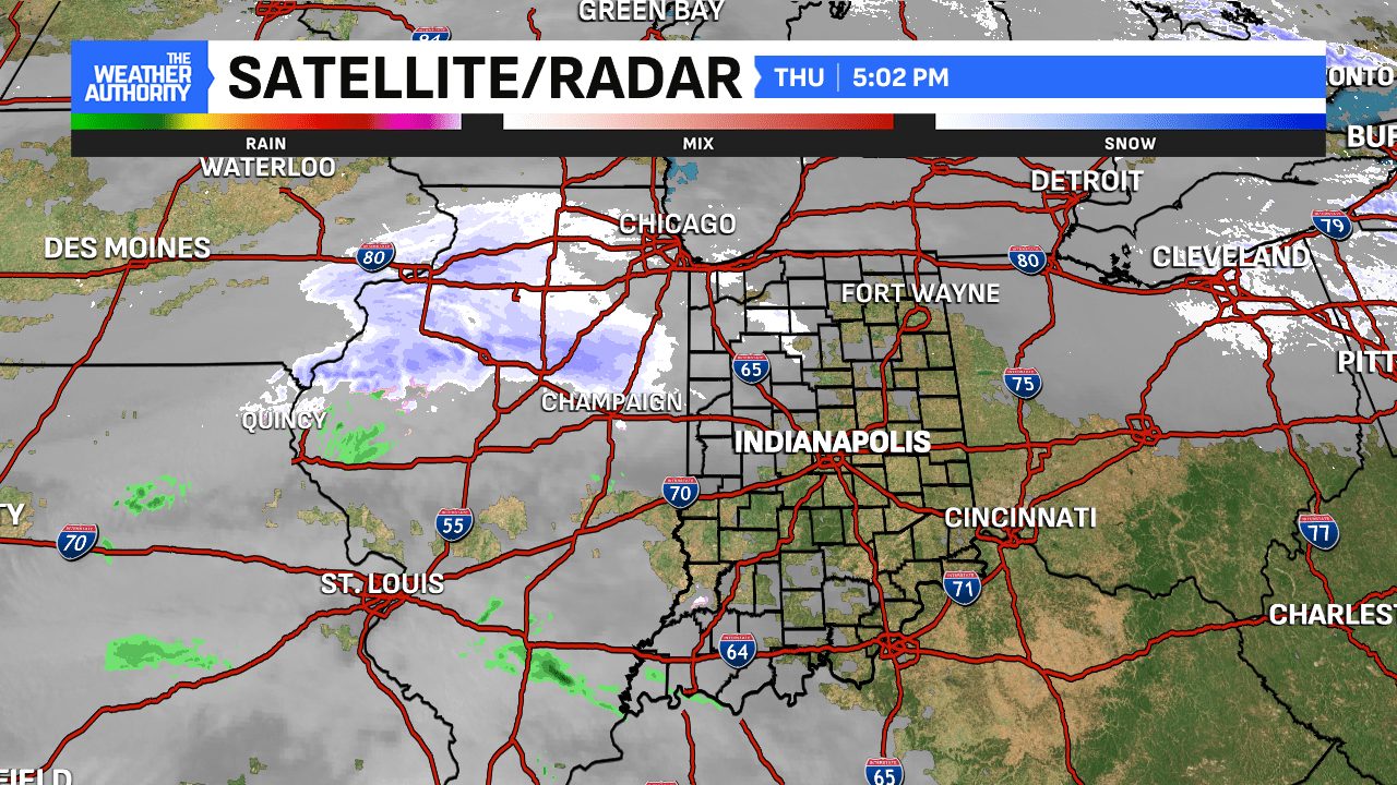
It’s the new year and we’re ramping up the snow machine rather quickly across Central Indiana. A few rounds of snow are on tap with the first beginning this evening. Then, potentially our biggest storm in nearly three years is on tap before very cold air arrives.
Round #1: Alberta Clipper drops quick accumulations late Thursday

This classic “Alberta Clipper” will move through here this evening. Peak coverage this evening into the overnight hours. The coverage will get out of here in time for daybreak Friday with sunshine to begin the day. When all is said and done, areas north and northwest could see 1-2″ of snow. Once you go south of I-74, that’s where less snowfall potential exists perhaps a dusting or so. Temperatures hold steady overnight in the upper 20s.


Winter tightens its grip: storm Sunday-Monday
It’s been something Central Indiana hasn’t seen in some time. For the first time about two years, a Winter Storm WATCH has been issued for Sunday-Monday by the NWS Indianapolis. Winter headlines exist for hundreds of miles across several states in the upper Midwest and Ohio Valley.


Indianapolis has not seen a Winter Storm Watch or Warning issued since January 25, 2023 (708 days ago). It’s also been 1064 days (February 3, 2022) since our last 6.0″+ one-day snowfall. That snow came with Central Indiana’s last decent snowstorm in early February 2022. Spots received anywhere from 5-15″ of snow during that time.


This snowmaker will have tons of moisture to work with. Spots in the path of this storm could see snow, sleet, ice or rain. For us, heavy snow is likely with more sleet/ice the further south you go.
In terms of timing, snow looks to begin around midday Sunday from SW to NE. Steady snow is likely through the day and into the overnight hours Monday. Something we’re monitoring is where the freezing line sets itself up on Sunday. This will determine who sees more snow and who sees more of a mix/ice. That mix will make snow totals go down significantly.
Because of that, South Central Indiana and spots even further south could see a sleet/mix rather than all pure snow. Any shift in track is key as we watch this storm evolve over the next few days.

Let’s talk about snow totals. We will get more specific starting Friday as we’ll be 48 hours out from the storm’s arrival. But some spots could approach half a foot or double-digit snow totals when all is said and done. Take a look at the Weather Prediction Center’s 72-Hour Snow Probabilities below for an early preview.
Travel impacts are likely. This is something else to watch as people travel home from the holidays or back to school/work Monday morning.
Arctic cold follows the snow
In the wake of the snow, a taste of the polar vortex moves south into the United States. For Central Indiana, this means highs in the teens and lows in the single digits/below-zero at many times. This will be the story for days heading into the middle of January. It will be fairly easy to get below zero with the snowpack our grounds will have from Sunday to Monday’s snow potential.
A few chances for flurries are also possible during the cold period, too. This comes during Central Indiana’s coldest period on average.


