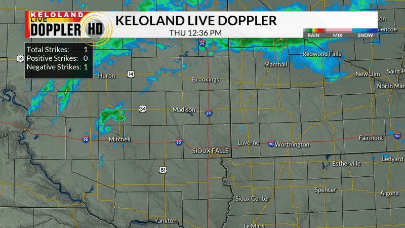
SIOUX FALLS, S.D. (KELO) —Scattered showers and thunderstorms returned to parts of KELOLAND yesterday. You can see the radar loop below shows the majority of the rain north of Sioux Falls. A few of those storms even produced some small hail in the late afternoon.

The official rain total for Brookings is .33″ and Marshall picked up .67″. Most other locations were dry or received very little rain.

Today, a nice autumn forecast is ahead for much of KELOLAND. Here are the hourly details for Sioux Falls.

The forecast shows many areas will be close to 60 later this afternoon under dry skies. We will see some scattered frost tonight with lows mainly in the 30s Saturday morning. Expect a developing south wind both Saturday and Sunday also with milder temperatures as we trend into early next week.

Expect a change in the weather next week as a stronger storm system moves our direction from the Rockies. It looks like more Gulf of Mexico moisture will be available and rain chances should increase Tuesday into Wednesday. We’ll be watching the details of this system over the weekend. In addition, there could be a second system in the plains late next week. We are still cautious to add big rain chances to the forecast with the ongoing drought impacting the entire region. However, these features will hopefully bring a few welcome changes to the forecast.

Here are the details of the forecast.


