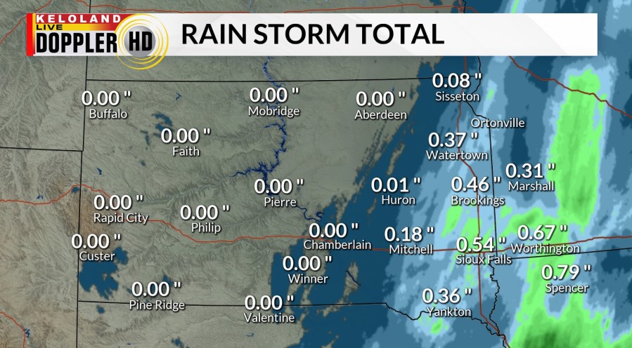
SIOUX FALLS (KELO) — The weather today looks dry compared to the rain we saw yesterday in eastern KELOLAND. You can see some of the rain totals on the map below, which includes .54″ for Sioux Falls. More precipitation is in the forecast next week.

Futurecast below shows dry conditions today as patchy fog in northeastern KELOLAND dissipates through the morning. Highs will be in the 50s and 60s through much of the region. Expect areas of fog to be more widespread tomorrow morning, followed by a stronger south or southeasterly wind by Friday afternoon. Highs will still average above normal in the 50s.

The weather forecast next week is looking more interesting. As you watch the video below, you’ll notice a system digging into the desert southwest again through early next week. This storm will take a track to the northeast again, but the exact path is far from certain. Adding to the uncertainty is a blocking high pressure center over southeast Canada. This will likely result in a stalled storm somewhere in the central plains next week. The longer it sits and spins, the better the chances for some snow on the backside of the system. On top of that, another storm may follow behind the first one, so we have several big challenges to tackle over the coming days.
So while the details are lacking, the chances of picking up some snow next week are already close to 50% in much of KELOLAND. Details will be coming your way in the coming days.

Here are the details of the forecast.


