SIOUX FALLS, S.D. (KELO) — KELOLAND isn’t the only area where we’ve had rain over the past week. Much heavier rain has fallen to our south, which ended up putting a dent in the drought monitor.
Sunshine and dry skies today as temperatures remained above average. This trend will continue Friday, but expect rain and cooler air to arrive for the first half of this weekend.
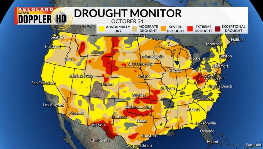
This is a look at the drought monitor across the country from last week.

From coast to coast, every state was labeled in some sort of drought. Some of the most intense drought was found in the north central and south central parts of the U.S.
But our rains over the past week have helped. This is a look at the rainfall over the past 7 days.

The heaviest of the rain fell to our south, from central Oklahoma to central Illinois. Rain amounts averaged from 5 to ten inches in this area.
Here’s the newest drought monitor.

While conditions have improved to our south, precipitation is still needed.
And KELOLAND can also use the precipitation as drought conditions have shown very little is any improvement.
And it looks like we’ll continue to see improvement as more storm systems are on the way. Not only to our south, but we’ll also watch for better precip chances for us.

