SIOUX FALLS, S.D. (KELO) — Here in the Storm Center we have done a few stories on the rain in the past couple weeks.
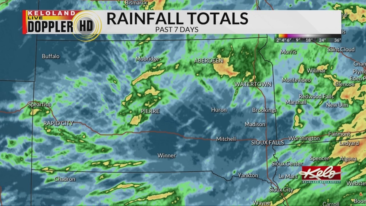
This map shows the areas that received rainfall in the last seven days.

The areas in yellow and red, specifically in north-central and northeastern KELOLAND, have had the most rain. South central and northwestern KELOLAND have had the least amount of rainfall, in the darker blues.
Some of that rain specifically between Aberdeen and Watertown fell Thursday and created flash flooding issues.
If we take a look at some of the numbers, there has been an abundance of rain. Pierre has above normal rainfall in the first few days of the month but is still coming below normal for the year.
In northeastern KELOLAND many locations have had close to or above normal rainfall. Watertown had almost an inch and a half of rain on Thursday, this put them well above normal for the month and the year so far. Just over a half an inch in Aberdeen on Thursday has put them well above normal for the month, and getting closer to normal for the year.
We have more rain in the forecast for everyone through the weekend, but the sun returns just in time for the new work week.