Hurricane Beryl is on a final approach toward Jamaica, where impacts could begin by the afternoon.
Even if Beryl’s center doesn’t make landfall, onshore winds along Jamaica’s south coast could drive serious storm surge of 6 to 9 feet. Hurricane warnings are in effect there and in the Cayman Islands, where impacts from Beryl could begin Wednesday night into Thursday.
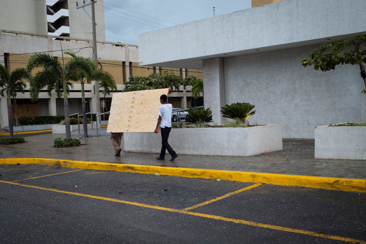
Jamaica ordered evacuations as the storm closed in, and Prime Minister Andrew Holness urged residents in those areas to head to shelters before conditions deteriorate.
“We urge all Jamaicans to comply with notices to evacuate,” he said. Even outside those warned areas, he said, “if you live in a low-lying area, an area historically prone to flooding and landslides, or if you live on the banks of a river or a gully, I implore you to evacuate to a shelter or safer ground.”
A 24-hour curfew was put in place at 6 a.m. Wednesday, said Oliver Mair, Jamaica’s consul general in Miami. By early afternoon, heavy flooding had already begun on the eastern end of the island, he said.
Drains across the island were recently cleaned, but their capacity to hold excess water is limited.
“Though we have prayed for the best, we know that there will be some level of damage,” Mair told The Washington Post. “There has been a big effort to move individuals from low-lying, flood-prone regions to shelters.”
Mair cited a “very good response” to the call to evacuate, saying Jamaicans were taking the storm’s threat seriously, especially upon hearing of the destruction on Grenada, St. Vincent and other islands.
The hurricane continues to move west after making landfall Monday on Grenada’s Carriacou Island. Grenadian officials said at a news conference late Tuesday that nearly 98 percent of homes and buildings on the hard-hit islands of Carriacou and Petite Martinique are either damaged or destroyed, including Carriacou’s Princess Royal Hospital and its airport. The electrical grid is mostly destroyed, they said, making communications difficult, if not impossible.
Grenadian Prime Minister Dickon Mitchell, who visited Carriacou on Monday, said that nothing could have prepared him for the extent of the devastation he witnessed. The hurricane has left the people of Carriacou and Petite Martinique “light-years behind.”
“It is almost Armageddon-like, almost total damage or destruction of all buildings whether they be public buildings, homes or other private facilities,” he said. “Complete devastation and destruction of agriculture, complete and total destruction of the natural environment. There is literally no vegetation left anywhere on the island of Carriacou.”
At a separate news conference in Florida on Tuesday, Dianne Perrotte, Grenada’s deputy consul general in Miami, said the islands are looking for donations of mattresses, sleeping bags, food and other supplies, as the airports slowly reopen for aid flights.
Grenadian officials have said at least three people were killed by the hurricane. In St. Vincent and the Grenadines, Prime Minister Ralph Gonsalves also reported severe damage and at least one death.
In Barbados, hundreds of people went to shelters, and at least dozens of houses were significantly impacted, said Rudy Grant, consul general of Barbados in Miami. Many businesses were hit in the fishing town of Oistins, a tourist destination, he said, and the port in the capital, Bridgetown, was closed until debris was cleared out.
Assessments of the damage would be continuing over the coming days.
“We are no longer prepared to accept that it’s okay for us to constantly suffer significant, clearly demonstrated loss and damage arising from climatic events,” Mitchell said, “and be expected to rebuild, be expected to borrow … year after year while the countries that are responsible for creating this situation and exacerbating this situation sit idly by with platitudes.”
“The impact of climate change and these weather events — they are getting more and more frequent and the consequences that much graver,” said Darrel Montrope, St. Lucia’s consul general in Miami. He said he anticipated ongoing aid needs in the Caribbean throughout the coming hurricane season.
Meanwhile, hurricane watches have been issued along the east coast of Mexico’s Yucatán Peninsula from Chetumal to Cabo Catoche. Beryl could hit the area as a Category 1 or 2 storm into Friday before emerging over the Bay of Campeche or the Gulf of Mexico this weekend.
From there, forecasts are more uncertain, with numerous possibilities for Beryl’s future track. Outcomes ranging from a weak tropical storm landfall in Veracruz or Tamaulipas in Mexico to a major hurricane reaching Texas are on the table. For now, it’s a game of waiting, watching and staying vigilant.
Though Beryl was some 1,800 miles from the southern Texas coast, officials in Willacy County near the Mexican border were already preparing for the worst.
That included readying relief supplies and search and rescue teams, and urging residents to pack bags and ensure they have enough food and water to last as much as 72 hours, said Frank Torres, the county’s emergency management coordinator.
As a coastal county with hundreds of homes right on the Gulf of Mexico, Willacy County will issue evacuation orders if it appears Beryl is on track to strike as a Category 2 storm or stronger by Sunday, Torres said.
“We have to take the mentality that it’s going to hit us,” he said. “If there’s the slightest possibility that it’s going to hit us, we just have to act as if we’re going to be ground zero.”
As of 11 a.m. Wednesday, the center of Beryl was located 125 miles southeast of Kingston, Jamaica. Maximum sustained winds in the eyewall were estimated at 145 mph, making Beryl a solid Category 4 hurricane.
If we look “under the hood” using microwave satellite imagery, we can see the southern eyewall is open. That said, the northern eyewall, which is more likely to skim along the southern edge of Jamaica, will contain winds gusting 100 to 130 mph. It will be a nail biter, since hurricane-force winds extend outward 45 miles from the center. Moreover, winds will begin out of the southeast. That will likely push water against the coast, leading to a storm surge of 6 to 9 feet.
Inland heavy rains, meanwhile, could trigger flash flooding and mudslides, which could sever routes into rural inland communities in the higher terrain. A few double-digit rain totals are possible.
The 2024 Atlantic hurricane season is only just beginning, and already Beryl has claimed a number of records in what has been a display of historical significance. The storm became the earliest-forming Category 5 on record in the Atlantic, beating out Hurricane Emily, which reached Category 5 strength on July 17, 2005.
Beryl was also the farthest-south Category 4 storm on record when it intensified over the weekend, and the most quickly strengthening storm observed in the Atlantic anytime before September; it lurched from a tropical depression to a Category 4 in just 48 hours.
While favorable meteorological conditions — like weak upper-level winds, the presence of a tropical wave and divergence, or spreading of air aloft — all combined to create the storm, its intensity is to some extent linked to our changing climate.
Water temperatures, which are running 3 or 4 degrees above average, are more reminiscent of early September than late June or early July. That has fueled Beryl’s exceptional intensity and breakneck strengthening, and fits into a well-researched pattern of more intense and more rapidly intensifying hurricanes.
“This is almost like a game changer,” said Mair, the Jamaican consul general. “To have this size hurricane so early in the season, it’s frightening.”
Where Beryl is headed next
Beryl will continue drifting west over the coming days, likely bound for the Yucatán Peninsula. An impact somewhere south of Cancún is likely Thursday night into Friday. By then, Beryl will probably be a Category 1 or 2 hurricane.
Beryl will be battling increasing shear in the next 36 hours, which will work to quickly weaken the system. That will be counteracted by exceptionally warm sea surface temperatures, which will continue to invigorate the system. The net result will likely be only gradual weakening, and a still-formidable impact in Mexico.
Will Beryl reach the Gulf of Mexico or the United States?
By Friday afternoon, Beryl is expected to emerge into the Bay of Campeche or the southwest Gulf of Mexico. That’s when forecast confidence drops off markedly.
If Beryl is a weak system, it will be inclined to continue heading west, probably making landfall over the weekend in Tamaulipas, Mexico. If Beryl remains stronger, however, which would be the result of a briefer interaction with the Yucatán, then it could take a more northerly track. That could take the storm over the western Gulf of Mexico.
If the latter scenario occurs, the storm could strengthen and perhaps rapidly intensify Saturday into Sunday, fueled by very warm sea surface temperatures, calm upper-level winds and high pressure aloft, which would result in spreading air that would vacuum surface air upward.
The threat of a landfall in Texas is a very real possibility, though Mexico remains more likely at this point.