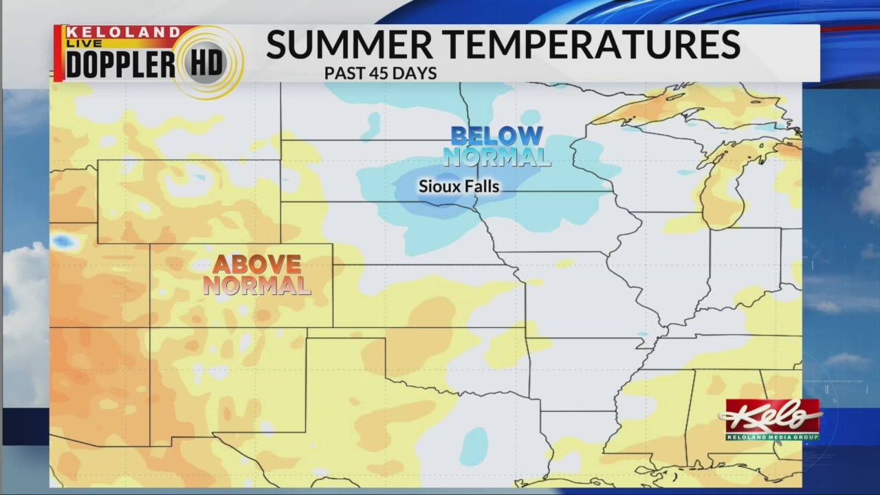
SIOUX FALLS, S.D. (KELO) — After a summer of wet weather in eastern KELOLAND and more below-average temperatures, all signals are pointing toward hotter weather just around the corner.
So far this summer, much of eastern KELOLAND has actually ranked below average for temperatures since early June. You can thank all that wet weather at the start of the summer season for much of that trend. However, the weather patterns are changing and hotter weather will be moving into our region.
You can see the push of above-normal temperatures in the Pacific Northwest.

All indicators suggest this heat will expand eastward over the coming days. Look how big that heat footprint will become by early next week.
That means highs in the 90s are likely and 100s are expected at times in the west.
One limiting factor in the heat is the smoke in the air. That haze in the sky can limit high temperatures by partially blocking sunlight during the peak heating of the day.
Having said that, it’s still important to remind yourself to drink lots of water and try to limit your work during the hottest part of the day as we enter the hottest stretch of weather so far this summer.