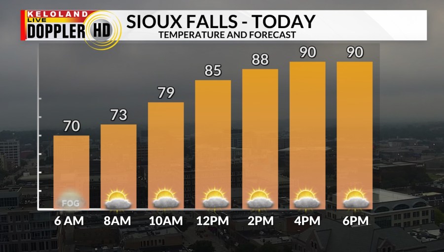
Good morning KELOLAND! Another hot and humid day is ahead for eastern KELOLAND. Sioux Falls will see highs in the lower 90s with hazy skies this afternoon.

Rapid City will not be as hot as yesterday with highs in the mid 90s. A few scattered t-storms are also possible in western SD this afternoon.

Yesterday’s highs reach the 100s in much of western SD. 110 was the high in Buffalo. Sioux Falls stayed cooler at 85.

We have been been tracking a few light showers in the far northwest corner of South Dakota. Most of this moisture has been very limited so far.

We will pick up that better chance of scattered rain in western SD later today. Highs should be in the 90s for most of the region, with more 90s tomorrow.

We also expect some stronger winds from the south the next couple of days. You can see that wind forecast on map below.

There could be some severe weather over the coming days. You can see the “marginal” risk today across western SD.

The marginal risk expands to the north and east tomorrow.

A broader zone of storm potential exists on Sunday.

Here are the rain chances ahead this weekend.


Here are the details of the forecast.


