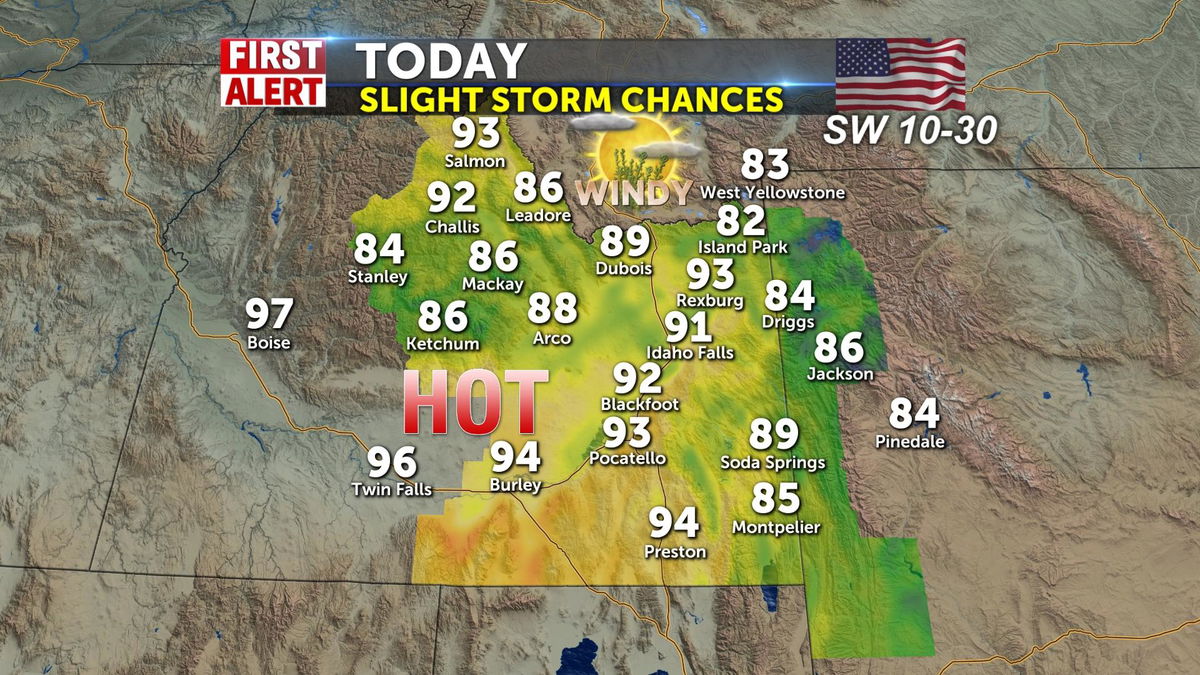
High pressure over the area makes for more heat today with SW winds shifting 20-30mph later. Highs will be approaching the low 90’s in Idaho Falls and mid 80’s for Jackson Hole. You can’t rule out a scattered shower/isolated storm and some of those could be dry thunderstorms.
Hot winds and busting mid 90’s for Pocatello, with a cold front approaching, and we’ll use the word “cold” loosely. Cool front will take our temperatures down by about 10 degrees for Wednesday before pressure pushes the heat up again.
A cooling trend will blast through for Wednesday taking temperatures in the mid 80’s and partly to mostly sunny conditions. It will be a long dry warm set of days until July 4th weekend. A slight shower chance hits just before July 4th Monday with some relief from 90 degree temperatures dropping temps into the upper 80’s for the holiday.
Jeff Roper, First Alert Weather