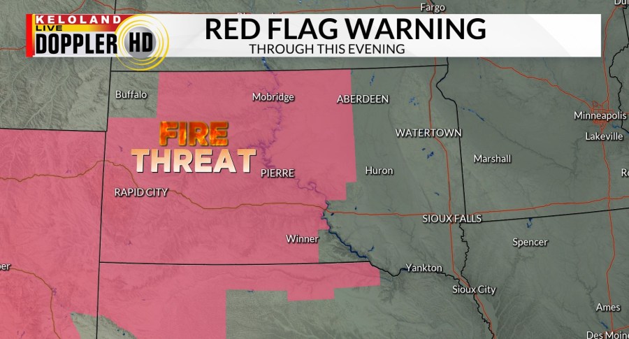
SIOUX FALLS S.D. (KELO) — Warmer temperatures low humidity and strong winds will all contribute to a red flag warning today for much of western and central South Dakota. This warning does include the entire Black Hills, Rapid City, Pierre, and Mobridge.

Fire danger will continue into tomorrow with a fire weather watch in effect for much of eastern South Dakota. Expect more red flag conditions also in western South Dakota. Stay very vigilant about potential sources for fires and use plenty of common sense as strong winds, low humidity, and warm temperatures will all combine to the high fire threat.

Here’s a closer look at the wind forecast the next 24 to 36 hours. South winds will increase today across the red flag warning areas at 20 to 40 mph. Steady S winds will continue to night, with gusts near 40 mph possible near Milbank and the Buffalo Ridge in southwestern Minnesota Saturday morning. In addition, we expect a strong cold front to enter northwestern South Dakota Saturday morning. Winds could gust over 50 mph in Rapid City with an expansion of 20 to 40 mile per hour winds likely across kettle land on Saturday.

Futurecast also shows the temperature trend today climbing into the 70s in the east, with 80° weather in the West. 80s will shift into eastern KELOLAND tomorrow as the cold front will deliver cooling trends in northwestern South Dakota.

It should come as no surprise that the 10-day forecast remains dry.

Temperatures also look to climb next week. It looks like record-breaking temperatures will be possible toward the end of the seven day forecast period. We’ll continue to monitor this trend.

Here are the details of the forecast.


