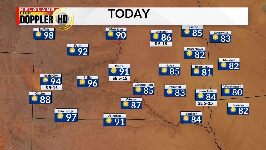
SOUTH DAKOTA (KELO) — It will be another day with slightly warmer air and isolated showers and storms.

Today’s best chance for an isolated storm will be in western South Dakota Highs will reach the 80s and 90s with only more heat to come.

But keep in mind, any storms that develop may become severe with strong wind being the main threat. There’s a marginal risk for severe storms in western South Dakota.

We’ll hold a small chance for isolated storms in central South Dakota tonight. Temperatures will fall to the 60s.

Tomorrow will bring in (yet again) slightly hotter temperatures. Which means, a better chance for more widespread 90s and 100s. At the same time, southerly winds will also bring in higher dew points to eastern KELOLAND, which means an increase in humidity.

Once again western South Dakota will have an isolated storm with a marginal risk for severe storms.

The heat and humidity will be in full force for the weekend. Expect air temperatures in the 90s and 100s with dew point temperatures in the 60s and 70s in central and eastern KELOLAND. This will bring the heat index (feels like temperature) to the 100s for many. Stay hydrated and take frequent breaks with any outdoor plans this weekend.

As we get into next week, the ridge will flatten and KELOLAND will be in zonal flow (west to east). As this happens, we’ll have to watch for any pieces of energy that will ride the zonal pattern which will bring scattered storms to the area.