
Low humidity and high winds in Colorado’s mountains and foothills bring red flag warnings and fire danger to the state’s western side Saturday while severe storms continue over the Eastern Plains.
“A red flag warning means warm temperatures, very low humidities and stronger winds are expected to combine to produce an increased risk of fire danger,” according to National Weather Service fire officials.
NWS officials issued a red flag warning for northwestern Colorado on Saturday — especially around Dinosaur National Monument, White River and the Colorado River Basin. The warning takes effect at noon and will remain active through 9 p.m.
According to the red flag warning, forecasters expect the relative humidity to drop to 5% and wind gusts to reach up to 30 mph in northwestern Colorado.
Park County in central Colorado will also be under a red flag warning Saturday afternoon.
Starting at 2 p.m., dry and breezy conditions in most of Park County — including areas near Lake George, Red Hill Pass and Buena Vista — will “lead to critical fire weather conditions,” NWS forecasters said.
Although they aren’t under an official red flag warning, NWS forecasters warned Saturday morning that most of Colorado’s foothills and mountain valleys would see elevated fire weather conditions due to the dry weather and gusty winds.
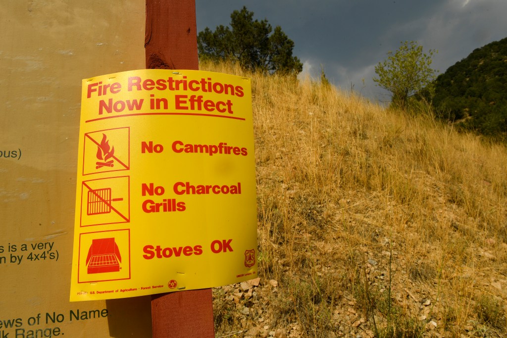
Do not throw cigarettes or matches out of a moving vehicle, drown fires with plenty of water and stir to make sure everything is cold to the touch and never leave a fire unattended, NWS fire officials stated.
Out east in the plains, forecasters said strong storms are expected to form in Logan, Phillips and Sedgwick counties. The three counties make up the northeastern tip of Colorado, where the state borders Nebraska.
“The primary threats from these storms will be hail and strong winds,” NWS forecasters said in a hazardous weather outlook.
Stronger storms and severe weather are expected to hit across most of Colorado Sunday, forecasters said.
The storms will bring hail, gusty winds and heavy rain to the mountains and foothills, Front Range and Eastern Plains, according to the hazardous weather outlook. There is a risk of flooding in the Cameron Peak burn area.
Rain showers and thunderstorms will douse the metro area between noon and midnight, forecasters said.
Around Denver, forecasters expect the rest of the week to be drier and warmer. Near-record heat is expected Friday, with temperatures climbing up to 100 degrees.
Get more Colorado news by signing up for our daily Your Morning Dozen email newsletter.