SIOUX FALLS, S.D. (KELO) — Recent weather conditions are continuing to fuel fire danger concerns across KELOLAND.
Meteorologist Jaelyn Borresen takes a look about what contributes to wildfires and how you can help prevent them from happening.
Fire weather has been one of the top headlines across KELOLAND over the past few weeks. Recent weather conditions with well above average temperatures, strong winds, and low humidity have contributed to an increased risk of wildfires.

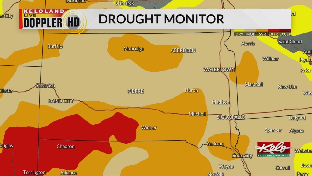
The dry weather has continued to worsen drought conditions. The latest drought monitor shows that most of KELOLAND is in a moderate to severe drought, while southwestern South Dakota is struggling with extreme drought. One of the effects of drought is the lack of moisture in the soil, which leads to vegetation drying out and quickly becoming fuel for wildfires.

If the risk for fire danger increases, a Red Flag Warning is usually issued for an area. The criteria for these warnings include frequent wind gusts above 25 mph, minimum relative humidity at or below 25 percent, and dry vegetation.
If the risk for fire danger increases, a Red Flag Warning is usually issued for an area. The criteria for these warnings include frequent wind gusts above 25 mph, minimum relative humidity at or below 25 percent, and dry vegetation.
In these conditions, it is best to avoid outdoor activities that involve open flames, along with equipment that could spark, such as lawnmowers. There are times when a burn ban may be issued by officials and prohibit outdoor burning in certain areas. This occurred just this week in rural parts of Minnehaha County. Additional safety precautions include keeping vehicles off of dry vegetation and disposing of cigarettes properly.
Elevated to critical fire weather conditions are likely as we head into Friday with record warmth possible in southeastern KELOLAND.