
It’s been chilly and rainy in metro Detroit since late Tuesday night, and it just keeps getting wetter.
Remnants of Hurricane Beryl, the first hurricane of the 2024 season, are causing heavy rain over the Midwest, which will persist in Southeast Michigan throughout Wednesday as the storm moves over Lake Erie.
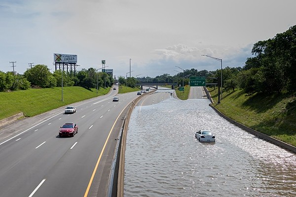
A flood advisory has been issued for metro Detroit until 4 p.m., and a flood watch is in effect for most of Southeast Michigan until 8 p.m.
Prepare to take action if necessary, as excessive rainfall may cause flooding of low-lying streets, rivers, creeks, and streams. Some flooding has already occurred, so check your basements periodically, especially if you’re in a flood-prone area.
With the heavy rain, Wednesday’s temperatures have been primarily in the low 70s, which feels pretty cold following the early 90 degree weather that the area has experienced recently.
The air will be drier with highs in the upper 70s on Thursday.
By Friday, the heat and humidity will return, with parts of the weekend and early next week feeling like over 90 degrees.
Stay dry today, but you may want to get wet again soon since it’ll be so hot.