Temperatures will dip overnight behind a passing cold front but the first freeze of the season for the city is still on hold
WELCOME THAT RAIN
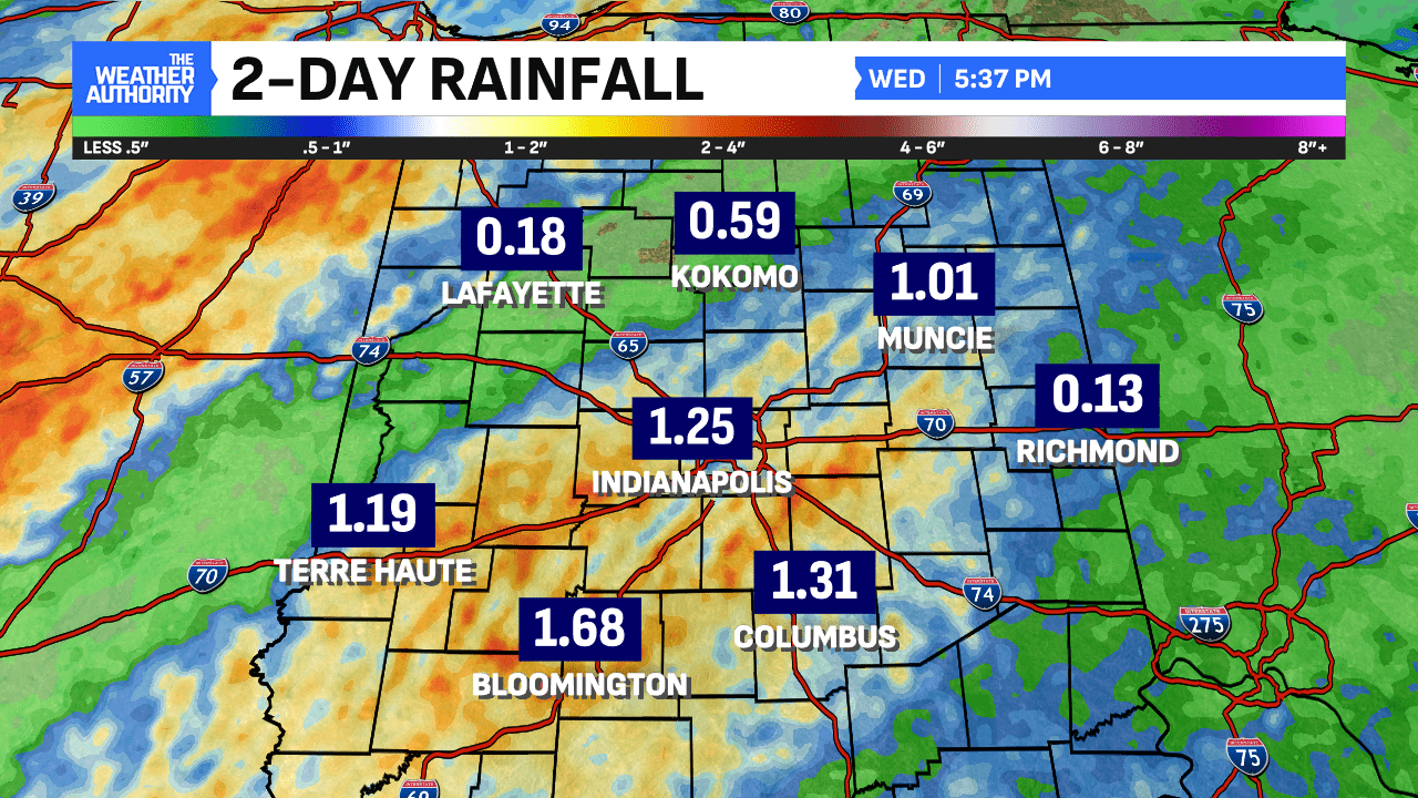
For the first time in a long while, an areawide rain fell across central Indiana. While eastern Indiana did not get great totals any rain to fall was needed. The two-day totals were the largest in since late July (1.25″). Largest tally 2.39″ in Spencer (Owen Co).


COOLING COMING
Getting behind a cold front tonight and temperatures are taking a slide. Low tonight slips into the 40s, still well above the normal low of 38° by as much as 10°. There’s cooling underway this evening but not before another 70° day – it’s the fourth straight! November 2024 is running with a temperature surplus of +68°. That’s +11° per day above normal. The average temperature for Fall 2024 is now among the warmest seven on record


Temperature highs will cool from 20° above normal to 10° above normal through the weekend. Warm November will roll along and continue well into next week. A renewed surge of 70s is possible before the coldest air of the season takes aim.

We end the work week with still no ‘first’ freeze in Indianapolis, and there’s still not one coming for at least another week. We’ve now reached 215 days since the last freeze, among the longest spells on record and are already among the ‘latest’ first freeze in years. It’s been 7 months (215 days) since the last freeze, April 6th. This is among only eight years on record with such a span between freeze dates. This is the latest first freeze since 2016’s November 12th date.

There looks to be a very cold surge behind a cold front next week after a windy and wet Wednesday. Stay tuned, we will watch that system for the threat of thunderstorms, gusty winds and the cold to follow in the days ahead.


