
SOUTH DAKOTA (KELO) — Aside from scattered showers in Minnesota and Iowa, we’re starting dry but that will change for some this afternoon and evening.
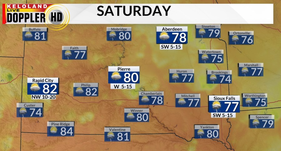
It’s one of those setups where morning and afternoon sunshine will help lift the air, eventually leading to scattered showers and storms in central and eastern KELOLAND. Highs will reach the 70s to near 80.
A lot of the rain will end as the sun sets and with partly cloudy skies during the overnight, lows will fall to the 50s and 60s.
Tomorrow will bring another round of scattered showers and storms. A lot of these will show up in central and eastern KELOLAND. Expect highs in the 70s and 80s.
There’s a better chance for dry weather on Sunday, but temperatures will remain slightly below average with highs in the 70s and 80s.
Next week is still looking hot in western South Dakota. Temperatures will return to the 90s in western KELOLAND by mid-week and continue into the weekend. We’ll be slightly cooler in eastern KELOLAND, but we’ll still get warmer as the week goes on.