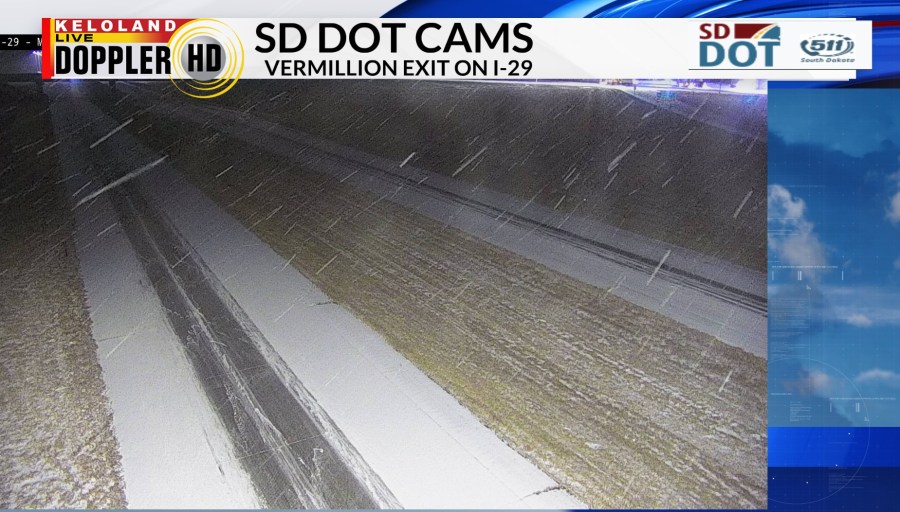
SIOUX FALLS, SD (KELO) —Good morning KELOLAND! We are starting the day with some slick spots on the roads in far southeastern KELOLAND. This was the view from the SD DOT camera network at the Vermillion exit on I-29 as of 5:30am.

You can see the snow track to the south of Sioux Falls overnight, with additional pockets of flurries to the northwest of Sioux Falls.
We expect a blend of sun and clouds today in Sioux Falls with near normal temperatures in the middle 20s.

Temperatures will be colder in northern SD today with highs in the upper teens in both Aberdeen and Watertown. We expect overnight lows to drop into the single digits tomorrow morning in parts of eastern KELOLAND. Meanwhile, flurries and pockets of light snow will try to develop West River during the day on Friday.
Speaking of snow, the chance of accumulating snow this weekend is looking good west of Sioux Falls on Saturday and Sunday.

It may even be enough to shovel in a few locations. Take a look at the latest chances of three inches of snow or more.

KELOLAND is not alone on the snow chances. In fact, this storm will intensity to our south early next week and produce areas of heavy snow and ice across Kansas and Missouri.

The animation below shows another perspective on the snow tracks this weekend. The biggest factor to watch for eastern KELOLAND is the push of cold air. If the cold arrives faster and stronger than predicted, the snow track will shift farther west into central and western SD. Ultimately, the Gulf of Mexico will interact with this storm well south of us early next week as temperatures stay below normal across the northern plains.
Here are the details of the forecast.


