
[ad_1]
In the last century, only nine hurricanes with winds topping 150 miles per hour have made landfall in the United States. Hurricane Ian became the tenth on Wednesday afternoon, striking the coast of southwest Florida as a Category 4 storm. Ian submerged entire barrier islands, ripped houses apart, and pushed a huge wall of water toward a chain of seaside cities from Sarasota to Fort Myers. It will likely flood thousands of homes.
Just five days ago, Ian was a weak tropical cyclone in the southern Caribbean. The storm underwent a process known as “rapid intensification” as it entered the warm waters of the Caribbean Sea, strengthening to a Category 3 hurricane by the time it made landfall in western Cuba. Scientists have found that climate change may make episodes of rapid intensification more likely by raising ocean surface temperatures. At least six hurricanes underwent rapid intensification during the 2021 hurricane season, and at least 10 during the 2020 season.
More than 200 miles of the Florida coast, home to 2.5 million people, were under a mandatory evacuation order in the days leading up to the storm. On Wednesday morning, the National Hurricane Center predicted that parts of Charlotte County, where the hurricane made landfall just north of Fort Myers, could see between 12 and 16 feet of storm surge — enough to submerge almost all coastal land.
“Nobody alive, nobody who has ever lived in Charlotte County, has ever seen what’s about to come,” Brian Gleason, the county’s communications director, told Grist. “Storm surge at that level is a deadly occurrence. No home is airtight, and if it’s not airtight it’s not watertight. If the wind starts taking out windows, and you’ve got seven feet of storm surge, it’s coming in the house.”
Roughly 30 miles south, Cape Coral resident Linda Bendon was hunkered down in her house with flashlights and a propane grill on Wednesday afternoon.
“This is our first big storm,” Bendon, who moved to Florida from upstate New York after retiring three years ago, told Grist by phone. “Wind is howling, and lots of stuff is flying around. Our bedroom window just blew out, and power is out.”
Bendon’s car has already been struck several times by uprooted trees, and she has been eyeing the rising water level in the canal across the street from her house. The canal is close to overtopping its walls, and flooding is widespread elsewhere in the area.
Initial forecasts suggested Hurricane Ian might hit the Tampa Bay metropolitan area, home to about 3 million people, but it curled south upon entering the Gulf of Mexico and veered toward Cape Coral and Fort Myers. After landfall, meteorologists expect the storm to move north through the state as a weakening tropical storm, then exit into the Atlantic Ocean before turning around and striking Georgia or South Carolina. The storm will drop several inches of rain on areas that have already seen double-digit rainfall totals in the past month, worsening the potential for floods.
“The majority of the state of Florida is in Ian’s crosshairs,” said Deanne Criswell, the head of the Federal Emergency Management Agency, or FEMA, at a press conference on Wednesday morning. The Weather Channel predicted widespread power outages from the coast all the way to the inland city of Orlando, and said some areas could be without power for weeks or months.
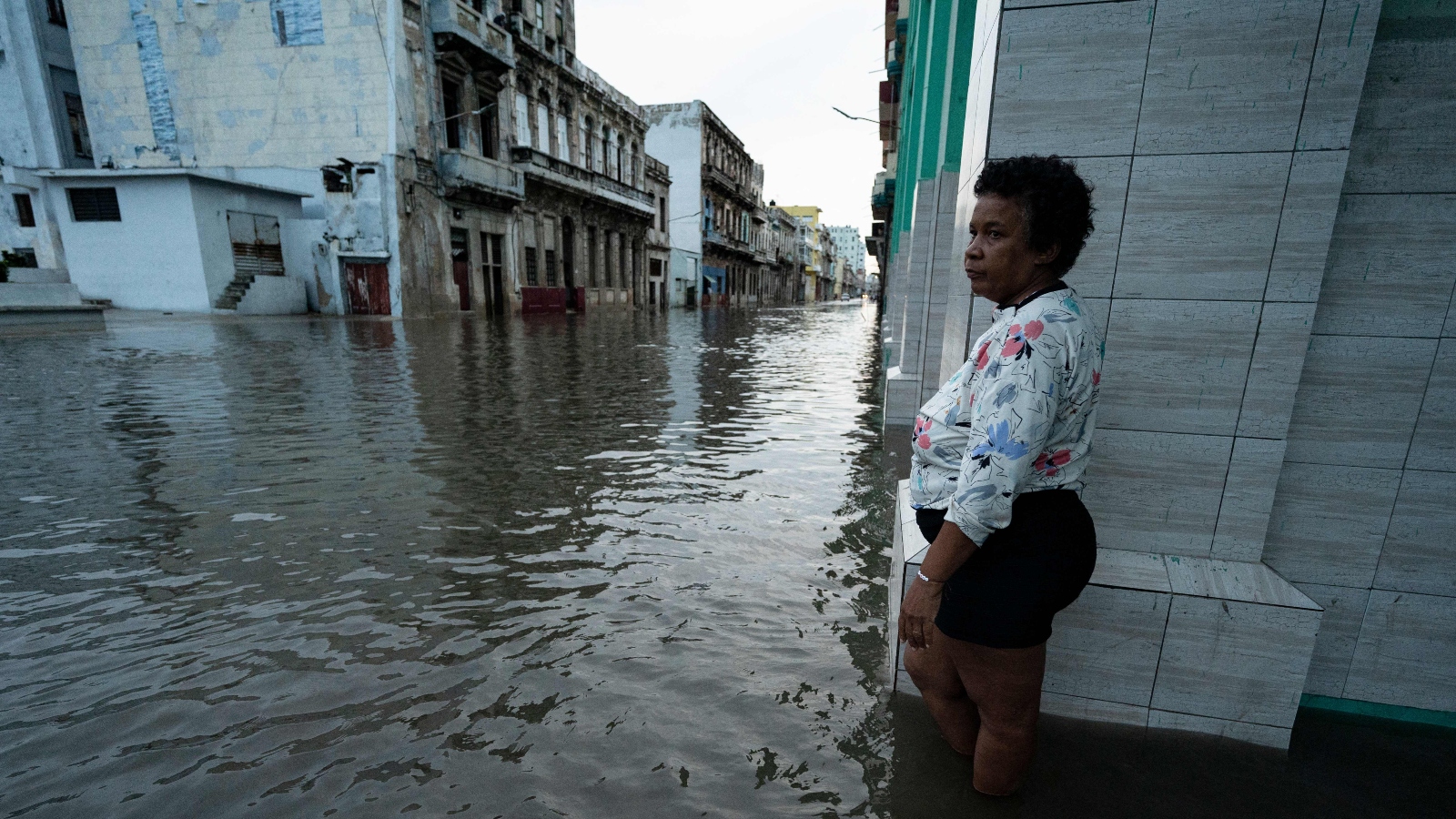
Even as Ian passed over Cuba on Tuesday night, it didn’t lose strength. It grew even stronger as it passed over the Straits of Florida. By early Wednesday morning, the storm had recorded winds of around 155 miles per hour, just below the threshold of Category 5 classification. The diameter of the storm stretched more than 300 miles, from Tampa to Havana. Radar scanners picked up individual gusts of 190 miles per hour.
“Catastrophic is an appropriate word,” wrote Phil Klotzbach, a hurricane expert at Colorado State University, on Twitter.
In Cuba, rampant flooding struck the province of Pinar del Rio, forcing residents to flee to higher ground. By late Tuesday evening, the government had reported that the entire country was without power: The storm had knocked out key transmission lines that convey electricity across the island. Crews were working to restore power through the night and into Wednesday morning.
The Florida Keys, which in the leadup to the storm were thought to be distant from Ian’s major effects, also saw widespread flooding. That’s thanks to the so-called king tides, a series of extra-high tides that arrive every autumn thanks to the alignment of the earth and the moon. The rotation of the storm combined with high tide on Tuesday night to produce the third-highest storm surge ever recorded in the Keys, overflowing canals and flooding cars across the islands. Flooding was expected to continue for several days as tides rose and fell.
“The tide keeps getting higher and higher,” Shanna Schroeder, a resident of Big Pine Key, told Grist on Tuesday night. “It’s not raining right now, but it’s very windy. We have water from the canal that is creeping into our backyard.” The water peaked early in the morning on Wednesday, she said, stopping just short of flowing into her house. Tracking buoys near Key West measured waves as high as 25 feet.
But as Hurricane Ian approached landfall, the primary concern for emergency management officials in southwest Florida was storm surge. That’s because the cities of Charlotte Harbor and Punta Gorda sit at the mouth of the Gasparilla Sound, a concave body of water that funnels out to the Gulf of Mexico. They also contain hundreds of man-made canals that funnel water away from homes and out toward absorbent mangrove forests. The storm surge from Ian is pushing all that water backward, overflowing backyard canals and flooding thousands of homes.
“The canal system is meant to convey water from higher parts of the county to the harbor,” said Gleason, the Charlotte County communications director. “When the surge comes up those canals, the 10 to 15 inches of rain that we’re gonna get has nowhere to go except up.”
There were similar concerns in Fort Myers and Cape Coral, which lie along the Caloosahatchee River and also contain hundreds of miles of residential canals. These cities are on the right-hand side of Ian’s circular motion, bringing the worst combination of storm surge and extreme wind. High-end projections suggested that most of the land area in both cities could be underwater for hours, and by Wednesday afternoon nearby barrier islands were already vanishing, along with coastal sections of Fort Myers.
Cape Coral is one of several coastal cities in Florida that faces enormous surge risk thanks to the audacious practices of twentieth-century real estate developers, who drained and reclaimed swampy coastal areas to create large suburbs on artificial land. The city’s intricate canal network allowed it to sprawl out across the marsh. As a result it briefly became the nation’s fastest-growing city, but it also left tens of thousands of people just a few feet above sea level. The scale of the risk became clear after 2017’s Hurricane Irma, which scraped the Fort Myers area on its way out of the Keys. It took years for the Fort Myers region to recover from even that glancing blow. With a direct hit from Hurricane Ian this week, a broader reckoning may be on the way.
[ad_2]
Source link