SIOUX FALLS, S.D. (KELO) — It was a stormy morning in northeastern KELOLAND. Just before 1:00 PM a report came in of a wind gust of 92 MPH in Hillhead in Marshall County. There is broken cloud cover around the area.
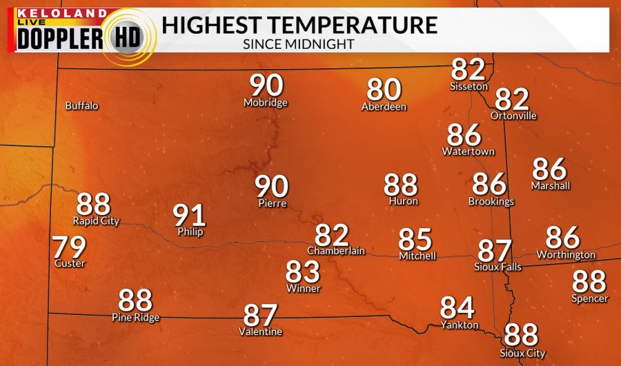
There are strong winds in western South Dakota, NOT under thunderstorms. Temperatures have been near and above normal, highs in the 80s and low 90s.

Eastern KELOLAND has very high humidity today. This adds energy into the air to fuel thunderstorms. Dew points were about the same and slightly higher than places like Miami and New Orleans. Here are some of this afternoon’s heat index values. That is combining the heat and the humidity to get what the air feels like. Even though Sioux Falls is 87°, it feels like it’s 99°.

There is a Severe Thunderstorm Watch in central and northeastern KELOLAND into this evening. More areas of KELOLAND could be added before the afternoon is over. Winds nearing 80 MPH, hail the size of tennis balls, even a tornado or two are possible if a storm pops up.

A few of those thunderstorms could linger in eastern KELOLAND overnight with party to mostly cloudy skies. Central and western South Dakota will have mostly clear skies. The wind will be mostly light unless you are under or near a thunderstorm.

The storms move out very quickly tomorrow morning. Then we will have sunshine across the area. The wind will stay mostly light, slightly stronger in southeastern KELOLAND including Sioux Falls. High temperatures will be very warm again with highs in the mid 80s to mid 90s.

Friday will feature more sunshine and even warmer. High temperatures will be in the 90s and a few triple digits in western South Dakota. The wind will be very light throughout the day.

We keep the sunshine and the heat around as we head into the weekend. A chance of thunderstorms starting Sunday in western South Dakota will help start cooling temperatures down. The thunderstorm chance moves through KELOLAND on Monday. The chance of thunderstorms continues daily in western South Dakota. We have much cooler air on the way with below normal temperatures on Wednesday.


