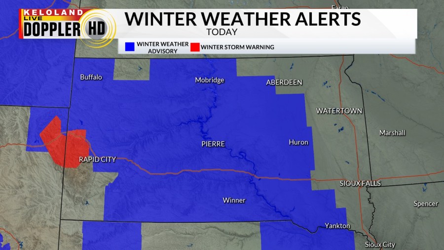
Good morning KELOLAND! We are tracking a wintry mix of rain, light freezing rain, and snow across the region this morning. You can see some of the snow falling in Deadwood where a Winter Storm Warning has been posted.
On radar, a mix of precipitation has been moving from west to east across KELOLAND this morning. Snow is becoming more widespread in the west as north winds increase at 20-40 today in Rapid City.
Winter weather advisories cover much of KELOLAND west of Sioux Falls today. Sioux Falls is currently not included in any of the advisories, but some snow is still on the way late this afternoon and tonight.

You can see the progression of the rain/snow mix across the region today as temperatures hold in the 30s. Readings will gradually fall late this afternoon and evening as rain coverts to more snow from north to south. Sioux Falls will have the best chance of accumulating snow after sunset. Expect cold and blustery north winds overnight into Tuesday.
Here’s a closer look at our snow forecast. Most of this snow will be a “nuisance” with 1-3″ in the advisory area as a general rule. We would like to pay attention to the south central around Winner and Gregory where 2-5″ is forecast. Again, that switch over from rain to snow will be critical to the snow totals forecast.

Get ready for cold air in January. All of our extended forecast data is showing very good chances of cold temperatures for several days. In fact, we could be looking at some brutal cold early next week.
We also may see some more snow by the weekend. Welcome to winter.
Here are the details of the forecast.


