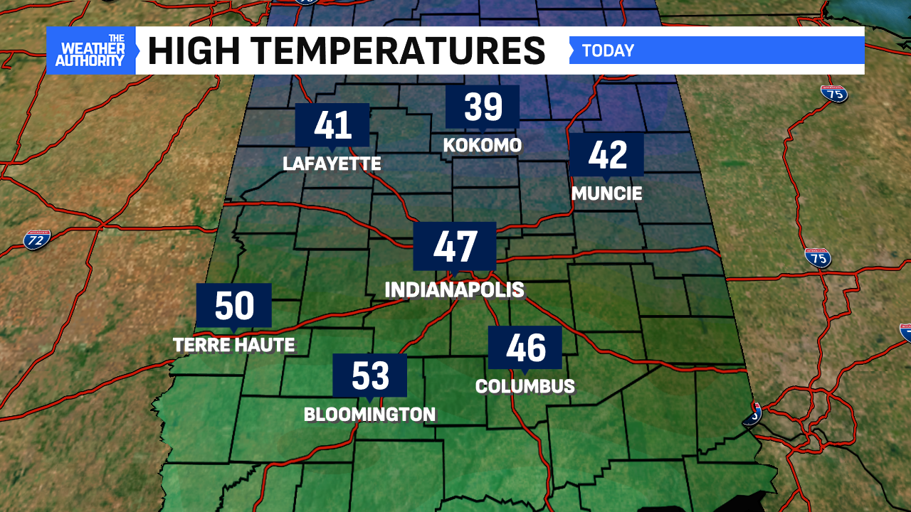
Several hometowns received some bonus sunshine today! Because of that, Indianapolis made it to 47° and spots south were even warmer. The temperature spread was quite high comparing Kokomo and Bloomington, with a difference of almost 15°. A boundary provided slight breaks in the clouds for some spots.


Rain is on the way for Christmas Day on Wednesday. The rain will be relatively light but will be steady, especially in the morning. Temperatures won’t budge much for Christmas Day because of the precipitation and persistent cloud cover. Expect high temperatures across the board in the 40s.


It will likely be the 66th Christmas Day since 1871 where Indianapolis records measurable rain. It was 19 years ago when the rainiest Christmas Day occurred (1.36″ in 2005).

While it will be mild for Christmas Day, the warmest days will follow the holiday. High temperatures will surge back to late October/early November levels Friday and Saturday. Highs those days will be in the mid-to-upper 50s. 60° is entirely possible on Saturday, too. Highs at these levels are nearly 20° above average. It will be these days when more persistent rain will occur across the region.


As we look further down the line toward New Year’s, that’s when we begin to see hints of our mild pattern potentially coming to an end. Temperatures look to slowly moderate back into the 40s for New Year’s Day next Tuesday. Once we get into 2025, we’re beginning to see indications that a potentially substantial cooldown may be in the works. Until then, enjoy the unseasonable mild and warmth. Happy holidays from all of The Weather Authority at FOX59/CBS4!


