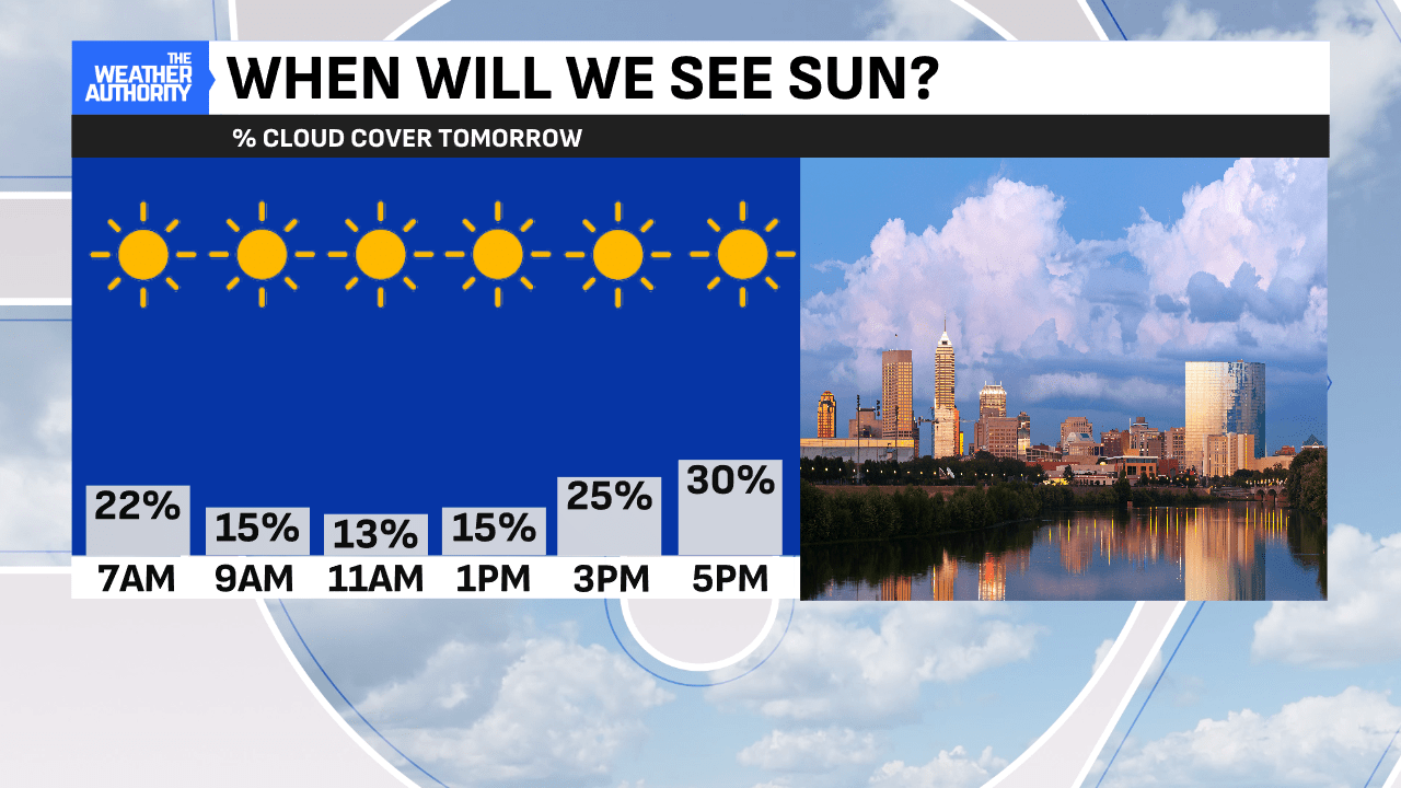
Saturday was pretty much a copy-and-paste day of Friday with highs in the low-to-mid 30s across Central Indiana. Highs in this range are a bit below normal and we’ll have this again for Sunday. It was nice to see the sunshine return. Further clearing will also take place to cap off the weekend.

Weekend finishes on a chilly note
Are you heading to Lucas Oil Stadium for the Colts home game against the Tennessee Titans? If so, bundle up for tailgating before as temperatures will be below freezing. The sun will act mighty deceptive because of the extra chill. Thanks to only a slight wind out of the south Sunday, we won’t have to worry about big-time wind chills. Expect highs to approach the mid-to-upper 30s across Central Indiana.

Warming & rainy trend starts Monday, continues to Christmas and beyond
High temperatures will begin to approach above-normal territory again on Monday. The daytime will start dry with rain chances going up in the afternoon and evening. The boundary responsible for this rain chance will stretch through the Hoosier State and back to the southern Great Plains. It will also be breezy Monday ahead of the rain with highs around 40°.
The next rainmaker will follow. This is the one which will be around for Christmas time. We’ll be warming further into the 40s for Christmas Eve Tuesday and Christmas Day Wednesday. Luckily, we are not expecting those days to be complete washouts by any stretch. The low-pressure center will likely track a bit further south keeping the bigger plumes of moisture away from central Indiana. However, still expect scattered showers at times.


Unfortunately, this means there will be no White Christmas again this year. This will be the second consecutive holiday with no snow. Instead, it will be the second consecutive holiday with rain. 32% of Christmas holidays since 1871 were a White Christmas for Indianapolis. The rainiest Christmas was 19 years ago in 2005 when 1.36″ of rain fell.


Each day next week and into next weekend does come with scattered rain chances. It also comes with even warmer temperatures surging well into the 50s just after Christmas. This will likely be the trend to end 2024 and ring in 2025.


