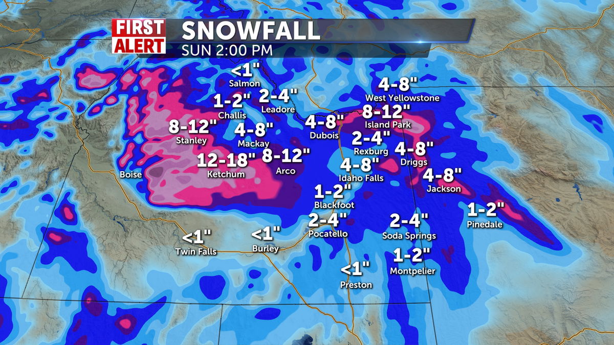
Looks like Jack Frost is finally coming to visit eastern Idaho and western Wyoming. Snow showers will become common with heavy snow likely for higher elevations with this storm. Here’s a breakdown:
Timing: early saturday morning through about midday sunday.
Snow totals vary significantly:
1-4″ for eastern snake river plane (Pocatello – Rexburg) with higher amounts of 4-8″ for western and far northern parts of the plane (Arco, Mud Lake, Ashton);
2-4″ for central mountain valleys with much higher totals of 10-20″ for the mountains;
2-4″ for SE highland valleys (Soda Springs, Lava Hot Springs) with 5-10″ for the area mountains;
4-8″ for eastern highland valleys (Jackson, Driggs) with 10-20″ for the mountains;
5-10″ for Island Park and other high mountain basins.
It will be windy especially Saturday night into Sunday morning. This will likely be the worst period for travel with wind-blown snow on mountain passes a possibility, and wind chills in the single digits. (Brrrr!!!)
By Sunday evening we clear out, but late Monday into Tuesday we have another chance for snow showers. Snow totals with this second system don’t look as impressive. Most places will range from 1-4″ with some mountain peaks pushing 8″ or so.
The rest of the forecast remains quiet with chilly temps as daytime highs stay in the 20s and 30s an overnight lows in the single digits and teens.

