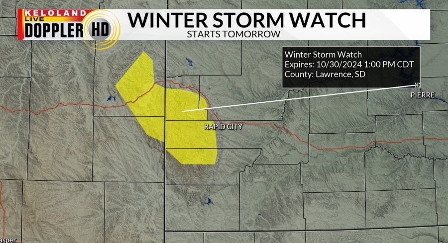
SIOUX FALLS, SD (KELO) —Ready for a change in the weather? Well, stay tuned. First, a winter storm watch has been posted for the central and northern Black Hills for the potential for heavy wet snow starting tomorrow into Wednesday.

The heaviest snow will be above 4500 feet. The potential for 6″ of more snow is in the forecast across the watch area, but we’ll have more details later today.

In the meantime, it will be a very mild day across much of KELOLAND with near-record highs in the Sioux Falls area. Expect 60s this afternoon in much of western SD. The first showers will develop in the Black Hills region tonight, with an expansion of rain chances tomorrow in western SD. Expect the rain chances to spread East River tomorrow evening into Wednesday. Some thunder and lightning can’t be ruled out in the southeast Tuesday evening. Expect much cooler weather on Wednesday.

The rain totals map below gives us some clues about the nature of this rain chance. Overall, we see a broader zone of rain in western, central, and northeastern SD with this system. Rain will also impact the southeast, but it may be more scattered in nature. Totals over a half inch are expected in western KELOLAND.

A break in the weather is expected by Thursday with cooler highs in the 40s and 50s. Another weather system could arrive in KELOLAND early next week…something to watch in the days ahead.

Here are the details of the forecast.


