A crisp, fall weekend caps off with seasonable highs in the upper 50s and lower 60s. We had abundantly sunny skies, continuing a very sunny October across Central Indiana. Now, we shift toward the closing days of October which calls for warmer temperatures, gusty winds and some needed rain in time for Halloween.
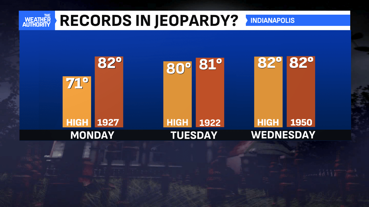
Monday will be pleasantly mild, with mostly sunny to partly cloudy skies and highs around 70°. This will be the transition day between the fall air this weekend and the September-like air midweek. We’ll have continued sunshine each day through Wednesday as we warm up. Highs Tuesday and Wednesday will approach 80° in several spots. Numbers like these are more typically seen in early-to-mid September. The forecast highs will come close to a 102-year-old high-temperature record Tuesday and a 74-year-old record Wednesday.

Tuesday and Wednesday will turn increasingly windy, too. Expect wind gusts close to 30 MPH on both days thanks to increased warm southwesterly winds. Be sure to hunker down any Halloween decorations that the wind may easily blow over! The higher winds will come ahead of a cold front late Wednesday-Thursday and its associated rain chances.
We’re currently running as the second-driest October to date with only 0.09″ of rain since the 1st. With measurable rain likely on tap Wednesday into Thursday, this is needed rain. In terms of trick-or-treating times, Halloween will start off wet. However, the rain may exit in time for trick-or-treating that night. The timing will be fine-tuned in the days ahead.


After that, we’ll cool off a bit with a sunny end to the work week. This comes as cooler, drier air settles back into the region behind the front. Highs near 60° on tap Friday with slightly warmer temperatures for the weekend. There will also be a slight chance of rain with it, too.
