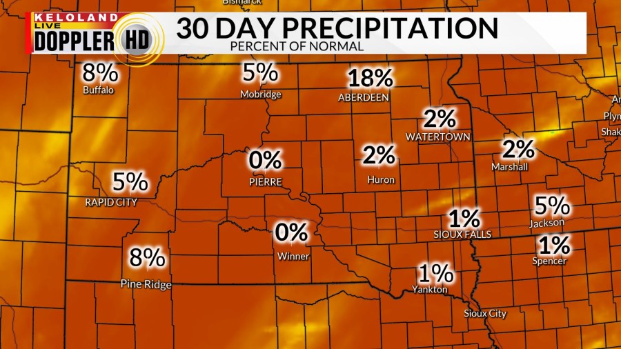
SIOUX FALLS, SD (KELO) —The weather continues to be very dry across KELOLAND, so some opportunities for showers today is big news. Most of the region is still well below normal the past 30 days, registering only a few percentage points above zero.

Highs yesterday reached the 70s and 80s across much of the region, near record territory for this time of the year.

If we see rain later this afternoon, it will be coming our way from northern Nebraska. You can see the trends after 4pm and we’ll continue to watch the radar scans later today. Most of this rain is in southeastern KELOLAND, with lesser chances in the northeast.

The map below shows the broader perspective as a few showers may also affect far southwestern SD. Temperatures will be mild across the region, but a cold tomorrow will shake things up with more wind from the northwest and another small chance of showers.

The wind forecast will be stronger tomorrow behind the front, but less wind and dry weather can be expected on Wednesday. Another system will be in the region on Thursday and may require some additional rain chances.

Here are the details of the forecast.


