A pleasant, sunny, and slightly hazy Sunday. If you didn’t get outside to enjoy it, you still have a bit more time before we see big changes in our forecast.
Monday, mostly sunny with once again a bit of haze in a few areas due to wildfire smoke. Daytime highs will be in the 70s across most of the region, though a few spots nudging 80 is not out of the question.
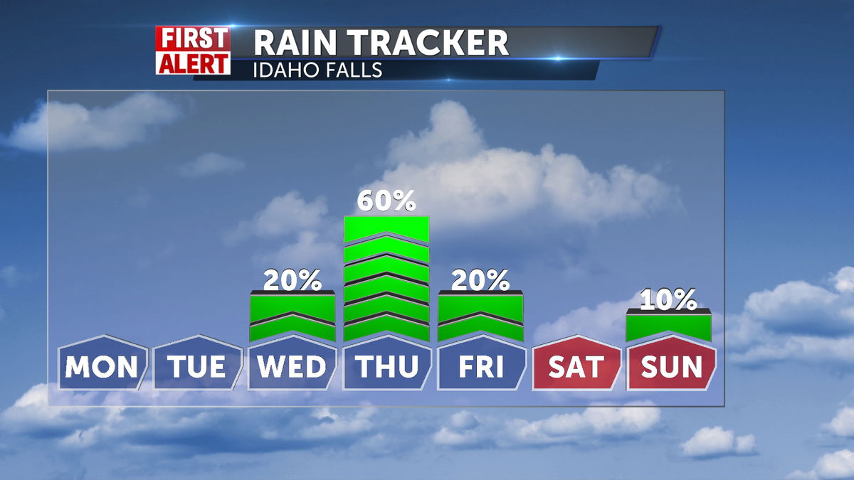
Tuesday, very similar to Monday. Mostly sunny, a bit hazy for some, and highs in the 70s.
Wednesday, the start of our transition as a cold front approaches. It will still be fairly sunny with daytime highs in the lower 70s. We’ll start to see winds picking up in the afternoon with possibly a shower or two in the central mountains in the evening.
The rest of the forecast brings big changes as the above-mentioned front impacts everyone on Thursday. Expect increasing clouds, winds and rain chances for Thursday with some leftover showers on Friday. Temperatures will take a big dip. Daytime highs on both days will only be in the 50s and 40s for most places. Overnight temps get especially chilly as the clouds clear Friday evening. Saturday morning lows will be in the teens and 20s across much of the region. This will likely be our growing season ending freeze for this year. The good news is, our weekend will be pleasant and fall like. Daytime highs will be cooler in the upper 50s and low 60s, but it will be sunny.