SIOUX FALLS, S.D. (KELO) — There’s no question we are in a dry cycle across KELOLAND. And with more dry air ahead, colder lower and hotter highs are expected in the forecast.
Dry air is going nowhere the next few days in KELOLAND. But there will be changes in wind and temperature, with some big swings pretty likely.
First, remember dry air results in lower dew points, which gives us the theoretical low temperature to our forecast. Dew points are forecast to hover in the 30s tonight in eastern KELOLAND, so patchy frost can not be ruled out north of Sioux Falls.
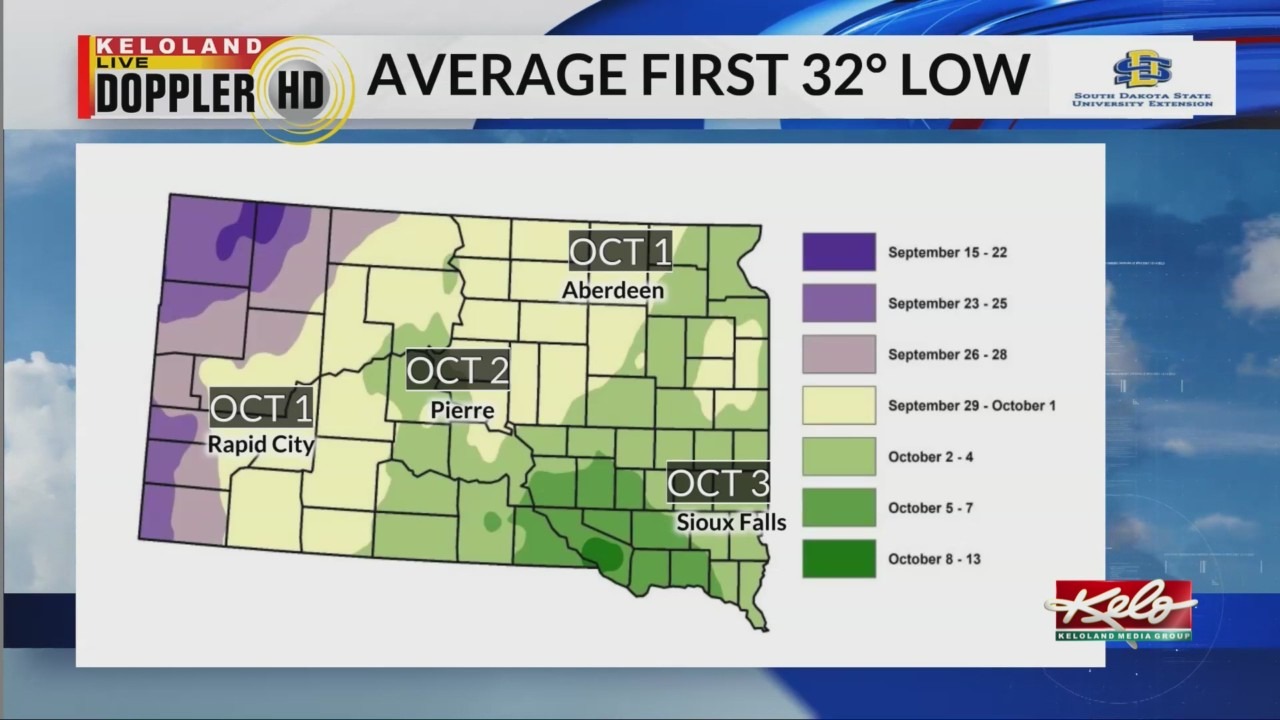
Looking at the climate data for KELOLAND, there is a 50/50 shot at 32 degree temperatures in much of eastern KELOLAND by early October. However, these conditions do not support a widespread frost or freeze. In fact, it’s unlikely we’ll see those conditions anytime soon.

The dry pattern will switch back to aiding hot weather for part of the region for the second week of October, with record highs possible.